Floristonrigg
| Floristonrigg | |
| Cumberland | |
|---|---|
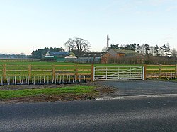
 Farm at Floristonrigg | |
| Location | |
| Grid reference: | NY358642 |
| Location: | 54°58’8"N, 3°0’13"W |
| Data | |
| Postcode: | CA6 |
| Local Government | |
| Council: | Cumberland |
| Parliamentary constituency: |
Carlisle |
Floristonrigg is a tiny hamlet in northern Cumberland, squashed against the M6 motorway, and between this remorseless road, the main Carlisle to Glasgow railway line and the last, tidal reach of the River Esk.
Carlisle is six miles to the south. The little village of Rockcliffe is two miles to the south, on the shore of the River Eden, and the tidal wetlands of the Rockcliffe Marsh, between the two rivermouths, stretch out to the west.