Little Stukeley: Difference between revisions
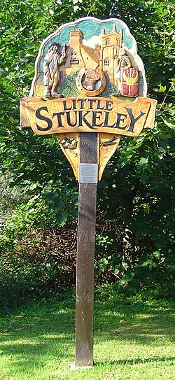
Created page with '{{Infobox town |name=Little Stukeley |county=Huntingdonshire |picture=UK_LittleStukeley.jpg |picture caption=Little Stukeley village sign |postcode=PE28 |latitude=52.365143 |long…' |
No edit summary |
||
| Line 13: | Line 13: | ||
The Stukeleys stand in the middle of the county, a little to the northwest of the [[county town]], [[Huntingdon]], along the local road out of Huntingdon towards [[Alconbury]]. Little Stukeley is the smaller of the two villages and lies to the northwest of its neighbour. | The Stukeleys stand in the middle of the county, a little to the northwest of the [[county town]], [[Huntingdon]], along the local road out of Huntingdon towards [[Alconbury]]. Little Stukeley is the smaller of the two villages and lies to the northwest of its neighbour. | ||
==Churches== | |||
*[[Church of England]]: St Martin's - a fine mediaeval church | |||
*Baptist: [http://www.findachurch.co.uk/churches/tl/tl27/alconburybc/ Alconbury Baptist Church] - an independent Baptist church, in Little Stukeley despite its name | |||
==About the village== | |||
There are many interesting cottages around the church in Little Stukeley, which have been declared a conservation area. The village has a post office, a village hall and a recreation ground. | |||
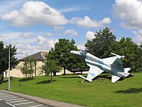
RAF Alconbury stretches all along the northeast side of the road from Alconbury, the whole length of Little Stukeley to the edge of Great Stukeley, its barracks blocks, now empty, covering a greater area than Little Stukeley itself. | RAF Alconbury stretches all along the northeast side of the road from Alconbury, the whole length of Little Stukeley to the edge of Great Stukeley, its barracks blocks, now empty, covering a greater area than Little Stukeley itself. | ||
[[File:War and peace - geograph.org.uk - 489199.jpg|left|200px|RAF Alconbury]] | [[File:War and peace - geograph.org.uk - 489199.jpg|left|200px|RAF Alconbury]] | ||
Latest revision as of 08:32, 22 May 2012
| Little Stukeley | |
| Huntingdonshire | |
|---|---|
 Little Stukeley village sign | |
| Location | |
| Grid reference: | TL208756 |
| Location: | 52°21’55"N, 0°13’37"W |
| Data | |
| Postcode: | PE28 |
| Local Government | |
| Council: | Huntingdonshire |
Little Stukeley is a village in Huntingdonshire. It and its larger neighbour, Great Stukeley, are collectively known as The Stukeleys.
The Stukeleys stand in the middle of the county, a little to the northwest of the county town, Huntingdon, along the local road out of Huntingdon towards Alconbury. Little Stukeley is the smaller of the two villages and lies to the northwest of its neighbour.
Churches
- Church of England: St Martin's - a fine mediaeval church
- Baptist: Alconbury Baptist Church - an independent Baptist church, in Little Stukeley despite its name
About the village
There are many interesting cottages around the church in Little Stukeley, which have been declared a conservation area. The village has a post office, a village hall and a recreation ground.
RAF Alconbury stretches all along the northeast side of the road from Alconbury, the whole length of Little Stukeley to the edge of Great Stukeley, its barracks blocks, now empty, covering a greater area than Little Stukeley itself.
