Bransdale: Difference between revisions
Created page with "right|thumb|300px|View across the dale File:Bransdale view from Bransdale ridge.jpg|right|thumb|250px|Bransdale from Bransdale Rid..." |
|||
| Line 16: | Line 16: | ||
{{reflist|30em}} | {{reflist|30em}} | ||
[[Category:Yorkshire | [[Category:Yorkshire Dales]] | ||
[[Category:North York Moors]] | [[Category:North York Moors]] | ||
[[Category:National Trust properties in Yorkshire]] | [[Category:National Trust properties in Yorkshire]] | ||
[[Category:National Trust properties in the North Riding of Yorkshire]] | [[Category:National Trust properties in the North Riding of Yorkshire]] | ||
Revision as of 20:51, 28 March 2023


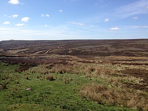
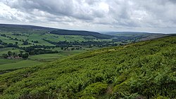
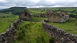
Bransdale is a valley running south through athe North Riding of Yorkshire, which is part of the North York Moors National Park.
This dale lies sandwiched between Bilsdale to the west and Farndale to the east: it is formed from the dales of Bransdale itself at the top of the valley, Sleightholmedale and Kirkdale. It carries a river called Hodge Beck[1] en route from Cockayne to the River Dove from Farndale three miles of Kirkbymoorside, which runs on into the Vale of Pickering and the River Rye.
History
Bransdale was historically divided between two ancient parishes. Bransdale Westside was a township in the parish of Kirkdale.[2] Bransdale Eastside was part of the township of Farndale High Quarter (also known as Farndale Westside) in the parish of Kirkbymoorside.[3]
Location
- Location map: 54°22’13"N, 1°2’47"W
References
- ↑ Taylor, James (19 March 1969). The Role of Water in Agriculture (1 ed.). Oxford: Pergamon Press. p. 40. OCLC 136617. https://www.worldcat.org/oclc/136617. Retrieved 25 January 2016.
- ↑ A History of the County of York: North Riding - Volume 1 pp @: Parishes: Kingsdale (Victoria County History)[1]
- ↑ Information on Bransdale from GENUKI