Normanby Top: Difference between revisions
Jump to navigation
Jump to search
Created page with '{{Infobox hill |name=Normanby Top |picture=Wolds Top - geograph.org.uk - 1538960.jpg |picture caption=The National Air Traffic Control Radar Installation(Claxby) |height=531 feet…' |
No edit summary |
||
| Line 1: | Line 1: | ||
{{Infobox hill | {{Infobox hill | ||
|name=Normanby Top | |name=Normanby Top | ||
|county=Lincolnshire | |||
|range=Lincolnshire Wolds | |||
|picture=Wolds Top - geograph.org.uk - 1538960.jpg | |picture=Wolds Top - geograph.org.uk - 1538960.jpg | ||
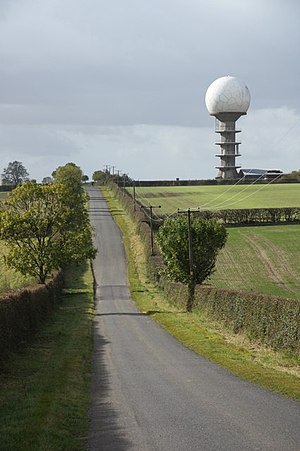
|picture caption=The National Air Traffic Control Radar Installation(Claxby) | |picture caption=The National Air Traffic Control Radar Installation(Claxby) | ||
| Line 11: | Line 13: | ||
Normanby Top is in [[Lindsey]], a mile or so north of the village of [[Normanby-le-Wold]]. The Viking Way passes close by, on a minor road, and there is a radio mast near the summit. The summit is marked with an [[Ordnance Survey]] triangulation station, which was erected in July 1999 as part of the Ordnance Survey national GPS system. | Normanby Top is in [[Lindsey]], a mile or so north of the village of [[Normanby-le-Wold]]. The Viking Way passes close by, on a minor road, and there is a radio mast near the summit. The summit is marked with an [[Ordnance Survey]] triangulation station, which was erected in July 1999 as part of the Ordnance Survey national GPS system. | ||
[[File:Looking down off the Wold Top - geograph.org.uk - 1128079.jpg|left|thumb| | [[File:Looking down off the Wold Top - geograph.org.uk - 1128079.jpg|left|thumb|250px|Looking down from the Top]] | ||
[[Category:County tops]] | [[Category:County tops]] | ||
Revision as of 23:11, 31 January 2012
| Normanby Top | |||
| Lincolnshire | |||
|---|---|---|---|
 The National Air Traffic Control Radar Installation(Claxby) | |||
| Range: | Lincolnshire Wolds | ||
| Summit: | 531 feet TF121964 | ||
Normanby Top or Wolds Top are names given to the highest point of the Lincolnshire Wolds, which also marks the county top of Lincolnshire.
Normanby Top is in Lindsey, a mile or so north of the village of Normanby-le-Wold. The Viking Way passes close by, on a minor road, and there is a radio mast near the summit. The summit is marked with an Ordnance Survey triangulation station, which was erected in July 1999 as part of the Ordnance Survey national GPS system.
