Hartley, Northumberland: Difference between revisions
Jump to navigation
Jump to search
Created page with "{{Infobox town |name=Hartley |county=Northumberland |picture=1930's Style Houses - geograph.org.uk - 541600.jpg |picture caption=Houses in Hartley |os grid ref=NZ335755 |lati..." |
No edit summary |
||
| Line 14: | Line 14: | ||
|constituency= | |constituency= | ||
}} | }} | ||
'''Hartley''' is a historic village in south-eastern [[Northumberland]], on the A193 road four miles south of [[Blyth, Northumberland|Blyth]] and | '''Hartley''' is a historic village in south-eastern [[Northumberland]], on the A193 road four miles south of [[Blyth, Northumberland|Blyth]] and the same distance north of [[Tynemouth]]. It was a farming and later colliery village but today is effectively part of [[Seaton Sluice]]. | ||
The population of the place at the 2011 Census was counted as 4,923. | The population of the place at the 2011 Census was counted as 4,923. | ||
Latest revision as of 16:34, 26 September 2018
| Hartley | |
| Northumberland | |
|---|---|
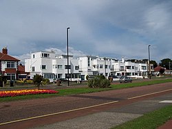
 Houses in Hartley | |
| Location | |
| Grid reference: | NZ335755 |
| Location: | 55°4’23"N, 1°28’37"W |
| Data | |
| Population: | 4,923 |
| Post town: | Whitley Bay |
| Postcode: | NE26 |
| Local Government | |
Hartley is a historic village in south-eastern Northumberland, on the A193 road four miles south of Blyth and the same distance north of Tynemouth. It was a farming and later colliery village but today is effectively part of Seaton Sluice.
The population of the place at the 2011 Census was counted as 4,923.
Outside links
| ("Wikimedia Commons" has material about Hartley, Northumberland) |
