Difference between revisions of "Template:FP-Kyle of Sutherland"
From Wikishire
(Created page with "{{#switch:{{{1}}} |pic=Christmas Day 2008 Kyle Of Sutherland - geograph.org.uk - 1090770.jpg |cap=The Kyle of Sutherland, between Sutherland and Ross-shire |text=The '''Kyle o...") |
(No difference)
|
Latest revision as of 20:53, 22 September 2018
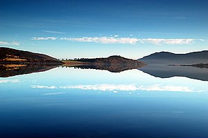
Kyle of SutherlandThe Kyle of Sutherland is a remarkable sea-loch or tidal river estuary that separates Sutherland from Ross-shire. The Kyle enters the Dornoch Firth and is fed by the rivers Oykel, Shin, Cassley and Carron. The lowest point of the Kyle of Sutherland is reckoned at the bridge at Bonar Bridge, below which is the Dornoch First. From here upstream the Kyle reaches twelve miles inland to its tidal limit which corresponds to 'the bailey bridge' at Inveroykel, southwest of Rosehall. (Read more) |
