Glenravel: Difference between revisions
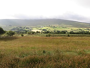
Created page with "right|thumb|300px|Farmland in Glenravel {{county|Antrim}} '''Glenravel''' is a bifurcated valley in the midst..." |
No edit summary |
||
| Line 5: | Line 5: | ||
The name of the Glen is from the old Gaelic words for 'Glen of the Berries'. | The name of the Glen is from the old Gaelic words for 'Glen of the Berries'. | ||
The rivers which form the glen run from the slopes of the mountains along the spine of the hills. The Cargan rises on the southern slopes of [[ | The rivers which form the glen run from the slopes of the mountains along the spine of the hills. The Cargan rises on the southern slopes of [[Slievenanee]], to the north, and becomes the Glenravel Water after it swallows the Ballsallagh Water off [[Collin Top]] and numerous burns of the hills, flowing south-westwards. The Skerry Water rises on Slievenanee's western slopes, and runs southwards. The two join at Martinstown to form the Clogh, which is ultimately a tributary of the [[River Main]]. | ||
The folk of Glenravel like to claim that theirs is the "the Tenth Glen" set beside the famous [[Glens of Antrim|Nine Glens of Antrim]]. While the Nine Glens run down to the sea on the county's eastern and northern coasts, Glenravel with much less spectacle, runs in the opposite direction, south-westwards into the county's inner parts. | The folk of Glenravel like to claim that theirs is the "the Tenth Glen" set beside the famous [[Glens of Antrim|Nine Glens of Antrim]]. While the Nine Glens run down to the sea on the county's eastern and northern coasts, Glenravel with much less spectacle, runs in the opposite direction, south-westwards into the county's inner parts. | ||
Latest revision as of 21:38, 30 November 2017

Glenravel is a bifurcated valley in the midst of County Antrim, cut through the Antrim Hills by two rivers and their headwaters; the Glenravel River and the Skerry Water, which unite in the glen to form the Clogh River, which itself carves a broad valley out of the hills westwards.
The name of the Glen is from the old Gaelic words for 'Glen of the Berries'.
The rivers which form the glen run from the slopes of the mountains along the spine of the hills. The Cargan rises on the southern slopes of Slievenanee, to the north, and becomes the Glenravel Water after it swallows the Ballsallagh Water off Collin Top and numerous burns of the hills, flowing south-westwards. The Skerry Water rises on Slievenanee's western slopes, and runs southwards. The two join at Martinstown to form the Clogh, which is ultimately a tributary of the River Main.
The folk of Glenravel like to claim that theirs is the "the Tenth Glen" set beside the famous Nine Glens of Antrim. While the Nine Glens run down to the sea on the county's eastern and northern coasts, Glenravel with much less spectacle, runs in the opposite direction, south-westwards into the county's inner parts.
There are three small villages in Glenravel: Newtowncrommelin on the south-flowing Skerry Water, Cargan, the northernmost and easternmost high on the Glenravel River, and Martinstown where the two rivers meet to form the Clogh. These villages and their glen are Over the watershed and south-west of Glenballyeamon and Glenariff, with the Glenariff Forest Park between.
History
The glen once provided an important route up through the Antrim Hills to the port that throve at Cushendun: the port was developed by the Crommelin family, who founded Newtowncrommelin in order to take advantage of the route.

Standing stones and artefacts such as arrowheads found in the area, denote an early habitation dating back to the Stone Age. This was a summer pasture for farmers in past ages, who built shielings here. Butter, buried into the moss, can still be found to this day in the local bogs. The practice known as 'Booleying' is reflected in the local name 'Booleynahallie'.
Around the start of the 19th century, Glenravel was a community of small farmers, dominated by two families: the Crommelin family and the Benn family. The Crommelins set to developing industry, without great success, while the Benns improved agriculture, planting trees and hedges and generally creating the landscape character as it is seen today.
The Benn family funded hospitals in Belfast and other charitable institutions including the Belfast Museum and the Royal Belfast Academical Institution, hence Glenravel Street in the city. George Benn 'The History of Belfast' in 1823.
In the 19th century, Nicholas Crommelin tried to exploit the iron ore in the glen, building a furnace in which, bizarrely, he chose to fire using local peat. His abandoned furnace still stands near Newtowncrommelin.
In 1866 though, James Fisher opened an iron ore mine on the slopes of Slievenanee, succeeding where Crommelin had failed. He also rented mining land from Edward Benn at £10 a year. In the first six months of 1866 Fisher was able to ship 18,000 tons of ore to Great Britain, worth about £1 a ton. By 1873 about 700 men were employed directly in the mines and 600 horses were used to cart the ore away. Much of the work done by the horse and cart was taken over by the railway, which opened in 1875 between Ballymena and Parkmore. The village closed and the railway shut down after the last train in 1937.
References
- Glenravel on Culture Northern Ireland