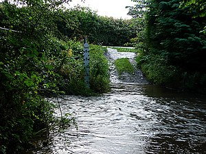
River Redlake: Difference between revisions
Jump to navigation
Jump to search
Created page with "{{county|Salop}} thumb|300px|River Redlake at Bucknell ford The '''Redlake''' is a minor river in south-..." |
No edit summary |
||
| Line 5: | Line 5: | ||
Its headwaters are to the south of [[Newcastle, Shropshire|Newcastle]], on the other side of Spoad Hill (alternatively Springhill).<ref name=survey>[[Ordnance Survey]] mapping</ref> | Its headwaters are to the south of [[Newcastle, Shropshire|Newcastle]], on the other side of Spoad Hill (alternatively Springhill).<ref name=survey>[[Ordnance Survey]] mapping</ref> | ||
It flows through [[Treverward]], [[Purlogue]], [[New Invention, Shropshire|New Invention]], [[Chapel Lawn]] and [[Bucknell, Shropshire|Bucknell]], briefly forming part of the county border, before passing | It flows through [[Treverward]], [[Purlogue]], [[New Invention, Shropshire|New Invention]], [[Chapel Lawn]] and [[Bucknell, Shropshire|Bucknell]], briefly forming part of the county border, before passing [[Coxall]] and discharging into the [[River Clun, Shropshire|River Clun]] at [[Jay]]. The very last part of the river, through [[Adley Moor]], is in Herefordshire. | ||
Historically it was known as the Bradfeld<ref>Maps: John Speed 1611; Drayton 1629</ref> or Bardfield.<ref>Map: Robert Morden 1695</ref> | Historically it was known as the Bradfeld<ref>Maps: John Speed 1611; Drayton 1629</ref> or Bardfield.<ref>Map: Robert Morden 1695</ref> | ||
Latest revision as of 10:42, 7 November 2017

The Redlake is a minor river in south-west Shropshire and northern Herefordshire.
Its headwaters are to the south of Newcastle, on the other side of Spoad Hill (alternatively Springhill).[1]
It flows through Treverward, Purlogue, New Invention, Chapel Lawn and Bucknell, briefly forming part of the county border, before passing Coxall and discharging into the River Clun at Jay. The very last part of the river, through Adley Moor, is in Herefordshire.
Historically it was known as the Bradfeld[2] or Bardfield.[3]
References
- ↑ Ordnance Survey mapping
- ↑ Maps: John Speed 1611; Drayton 1629
- ↑ Map: Robert Morden 1695
Outside links
- Location map: 52°22’55"N, 3°-0’43"W

This Shropshire article is a stub: help to improve Wikishire by building it up.