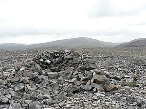
An Socach, Aberdeenshire: Difference between revisions
Created page with '{{Infobox hill |name=An Socach |county=Aberdeenshire |range=Cairnwell Hills |SMC=6 |picture=Summit of An Socach - geograph.org.uk - 57554.jpg |picture caption= |height=3,097 feet…' |
No edit summary |
||
| Line 7: | Line 7: | ||
|picture caption= | |picture caption= | ||
|height=3,097 feet | |height=3,097 feet | ||
|os grid ref=NO079799 | |os grid ref=NO079799 | ||
|latitude=56.901261 | |||
|longitude=-3.513749 | |||
}} | }} | ||
'''An Socach''' is a mountain of the [[Cairnwell Hills]] in [[Aberdeenshire]]. It reaches a height of 3,097 feet at its summit, and so it qualifies as a [[Munro]], and may be found some three miles west of the A93 road from [[Perth]] to [[Braemar]]. | '''An Socach''' is a mountain of the [[Cairnwell Hills]] in [[Aberdeenshire]]. It reaches a height of 3,097 feet at its summit, and so it qualifies as a [[Munro]], and may be found some three miles west of the A93 road from [[Perth]] to [[Braemar]]. | ||
Latest revision as of 07:58, 28 September 2017
| An Socach | |||
| Aberdeenshire | |||
|---|---|---|---|

| |||
| Range: | Cairnwell Hills | ||
| Summit: | 3,097 feet NO079799 56°54’5"N, 3°30’49"W | ||
An Socach is a mountain of the Cairnwell Hills in Aberdeenshire. It reaches a height of 3,097 feet at its summit, and so it qualifies as a Munro, and may be found some three miles west of the A93 road from Perth to Braemar.
It is a great bulk of mountain with a summit altitude of 3,097 feet. The name may derive from the Gaelic Soc, meaning the snout or beak, leading to the projecting place by analogy with the shape of a snout. Other sources state that it means 'the sow'.
Overview
An Socach stands to the south of Glen Ey. The summit ridge is curved and 2 miles long with tops at either end. The western top is the highest and the Munro summit, while the western summit, still at comfortably over 3,000 feet is till impressive.
The summit ridge arcs round a deep corrie with the only low level exit north of the summit. It is quite an impressive site. An Socach is best seen from Glen Ey where the sight of this impressive corrie is revealed. It is hidden from the east at the A93 by its neighbour Carn Aosda.
Ascents
The hill has an elongated, round form, and the Munro bagger is advised that the highest top is in fact at its western end and is not the 3,077 foot eastern summit as shown on certain OS maps.
The hill may be climbed from Glen Ey to the north or from the top of the Glenshee Ski Centre to the east. The Glenshee route involves a decent into Baddoch Burn, and so more climbing is required than the Glen Ey route, which is longer.
The summit ridge is normally attained by way of its eastern ridge and then on to the main summit by a long walk along the arced summit ridge. South of the ridge has a lot of scree and is best avoided. The usual approach is from a path at Baddoch Burn to the East starting out from the Ski Centre. This high altitude start makes it a rather easy climb over easy slopes. There are other routes that attack An Socach from the west which are infinitely more interesting but are much longer.
Outside links
References
- "The Munros" ed. Donald Bennett. ISBN 0-907521-31-2
| Munros in SMC Area SMC Section 6 - Glen Garry to Braemar |
|---|
|
An Sgarsoch • An Socach • Beinn Dearg • Beinn Iutharn Mhòr • Beinn a' Ghlò • Càrn a' Chlamain • Carn a' Gheoidh • Càrn an Fhidhleir • Carn an Righ • Carn Aosda • Càrn Bhac • Beinn a' Ghlò • Beinn a' Ghlò • Glas Tulaichean • The Cairnwell |