Cremyll: Difference between revisions
Created page with "{{Infobox town |name=Cremyll |county=Cornwall |picture=The Edgcumbe Arms, Cremyll - geograph.org.uk - 325092.jpg |picture caption=The Edgcumbe Arms, Cremyll |os grid ref=SX453..." |
|||
| Line 28: | Line 28: | ||
The village pub is The Edgcumbe Arms, which dates back to the 18th century. It was destroyed by fire and rebuilt in 1995.<ref>[http://www.edgcumbearms.co.uk/ The Edgecumbe Arms]</ref> | The village pub is The Edgcumbe Arms, which dates back to the 18th century. It was destroyed by fire and rebuilt in 1995.<ref>[http://www.edgcumbearms.co.uk/ The Edgecumbe Arms]</ref> | ||
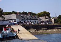
[[File: | [[File:Cremyll - Slipway cropped.jpg|right|thumb|200px|The slipway for the Cremyll Ferry]] | ||
==Sights about Cremyll== | ==Sights about Cremyll== | ||
Latest revision as of 23:09, 22 July 2016
| Cremyll | |
| Cornwall | |
|---|---|
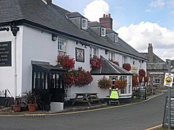
 The Edgcumbe Arms, Cremyll | |
| Location | |
| Grid reference: | SX453535 |
| Location: | 50°21’38"N, 4°10’33"W |
| Data | |
| Post town: | Torpoint |
| Postcode: | PL10 |
| Dialling code: | 01752 |
| Local Government | |
| Council: | Cornwall |
| Parliamentary constituency: |
South East Cornwall |
Cremyll is a small coastal village in south-east Cornwall, on the Rame Peninsula facing Plymouth Sound. It is close to Plymouth, about 9 miles by road or ½ a mile by boat, and a passenger ferry crosses the Tamar to Cremyll, largely to served visors coming to see Mount Edgcumbe House above the village.
History

There has been a ferry at Cremyll since the Saxons' arrival in the eighth century[1] and it was a link in the main southern route into Cornwall until the 1830s. There was a larger community here called West Stonehouse (compare with East Stonehouse) until it was burnt by the French in 1350. In mediæval times the ferry was part of the manor of Stone-House, held by the Valletorts.[2]
The Cornish side of Plymouth Sound was not always Cornish. It was incorporated into Anglo-Saxon territory in 705 AD in order to secure both banks of the estuary against, mainly Viking, raids. An area of the Rame peninsula (up to Kingsand) was considered to belong to Devon until the Counties (Detached Parts) Act 1844, when it was deemed to be part of Cornwall for all purposes.[3]
Mount Edgcumbe and Cremyll stand on the most easterly extension of the Rame Peninsula, known with ironic pride by local people as the 'Forgotten Corner'.
Culture and community
Today the Cremyll Ferry carries foot passengers and cyclists from Cremyll to Plymouth. Cremyll is on the South West Coast Path which is the longest of the waymarked long-distance footpaths in the United Kingdom.
The village pub is The Edgcumbe Arms, which dates back to the 18th century. It was destroyed by fire and rebuilt in 1995.[4]

Sights about Cremyll
The main entrance to Mount Edgcumbe House is in Cremyll. Mount Edgcumbe is a stately home, Grade II listed, whilst the gardens are listed as Grade I in the National Register of Historic Parks and Gardens. Around about is the Mount Edgcumbe Country Park.
Outside links
| ("Wikimedia Commons" has material about Cremyll) |
References
- ↑ Cremyll bus stop (1 ed.). cremyell: ccc. p. 2. http://www.explorethesouthwestcoastpath.co.uk/walk.php?walk_id=16. Retrieved 29 September 2015.
- ↑ Henderson, C. (1935) "Ferries in Cornwall", in Essays in Cornish History, edited by A. L. Rowse and M. I. Henderson. Oxford: Clarendon Press; pp. 163-67
- ↑ "Walks: The Cornish shores of Plymouth Sound". the aa. http://www.theaa.com/walks/the-cornish-shores-of-plymouth-sound-420157#background. Retrieved 29 September 2015.
- ↑ The Edgecumbe Arms
