Bayston Hill: Difference between revisions
No edit summary |
|||
| Line 2: | Line 2: | ||
|name=Bayston Hill | |name=Bayston Hill | ||
|county=Shropshire | |county=Shropshire | ||
|picture= | |picture=409880 a676a74c.jpg | ||
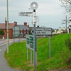
|picture caption=Berries Lane | |picture caption=Berries Lane | ||
|os grid ref=SJ482086 | |os grid ref=SJ482086 | ||
Latest revision as of 07:11, 4 February 2016
| Bayston Hill | |
| Shropshire | |
|---|---|
 Berries Lane | |
| Location | |
| Grid reference: | SJ482086 |
| Location: | 52°40’22"N, 2°45’55"W |
| Data | |
| Population: | 5,079 |
| Post town: | Shrewsbury |
| Postcode: | SY3 |
| Dialling code: | 01743 |
| Local Government | |
| Council: | Shropshire |
| Parliamentary constituency: |
Shrewsbury and Atcham |
Bayston Hill is a large village n central Shropshire. It is three miles south of the county town Shrewsbury and located on the main A49 road, the Shrewsbury to Hereford road.
Occupied continuously since before the Middle Ages, the village had a population of 5,079 residents in 2,172 households in the 2011 census. Bayston Hill mainly serves as a communter village for nearby Shrewsbury. It has the largest population for a village in Shropshire and the 10th highest population of any Shropshire locality. The village has a larger than average retired population in comparison to many similar Shropshire villages, but lower than the national average. Bayston Hill has three public houses, two churches (Church of England and Methodist) one primary school called Oakmeadow, and a public library.
Lyth Hill lies to the south of the village.
History
Early history
The village was recorded in the Domesday Book and there is remaining evidence of both an Iron Age hillfort and a Roman settlement located on the village's high grounds. In the Middle Ages the heavily wooded Bayston Hill and Condover area was established as a Royal hunting forest. A busy rope works complete with its own windmill built in 1835, existed on Lyth Hill in the 19th century; supplying the many mines, farms and barge owners across the district. A church was built alongside the village glebelands in 1843 to serve the local miners, quarrymen and railway navvies.[1]
Standing on the south east side is the village's oldest archaeological site of a mounded Iron Age bivallate hill fort, relatively low lying for a such a structure and oddly named with the Danish name of The Burgs, but probably was not called that until sometime between the 14th and 16th centuries.
Buildings
Great Lyth manor house was built in 1638 but had fallen into dereliction by 1948. In recent years it has been rescued and renovated.
In 1785 the London architect George Steuart designed and built a brick mansion house Lythwood Hall for the Blakeway family, which was accessed via a sweeping driveway through landscaped gardens to the west of the village. Steuart went on to build Attingham Hall for the 1st Lord Berwick but Lythwood Hall fell into disrepair under the squireship of the Hulton-Harrop family in the 1890s. It was later split into multi-ownership units.[2]
Bayston Hill was established as a new ecclesiastical parish with the building of Christ Church in 1843[3] as an amalgamation of sections from the parishes of St. Julian's Shrewsbury, Meole Brace and nearby Condover. The church was built to serve the local miners, quarrymen and railway navvies.[1] The ecclesiastical parish is part of the Diocese of Lichfield.
Modern history
The 1920s novels House in Dormer Forest and Seven for a Secret were written at Spring Cottage, Lyth Hill by romantic novelist Mary Webb who lived in the village on and off for ten years, alternating between Spring Cottage and her London home, until her death in 1927. The action in her most famous novel Precious Bane took place around the nearby Bomere Pool, that she called Sarn Mere.
A further literary connection can be found in the Brother Cadfael mediæval detective novels of Ellis Peters with much of the action in several stories taking place within the traditional forest, lanes and footpaths in and around Bayston Hill or between the village and other surrounding mediæval settlements.
The original 1843 Christ Church still stands. A modern successor church was built on a more central site for the newer housing estates in the early 1980s.
In 2001 an application to further extend the Bayston Hill quarry was turned down after a detailed survey identified six previously unknown historical sites of archaeological importance that would be destroyed by the proposed extension . These included sections of at least one or possible two AD 43 – 450 Roman roads, two 1066 -1547 mediæval or mid 16th century post-mediæval roads or trackways, a group of cropmarks suggesting historical earthworks or buildings, and a group of three mediæval parish boundary stones.
In August 2003, the section of the A5 road at Bayston Hill was closed after a large black cat was claimed to have been sighted at the service station. Experts from the West Midlands Safari Park assisted a police helicopter in search for the cat, which was not found.[4]
In early 2012 the parish council planned to rename itself a "town council" with a Town Mayor. The move was defeated in the face of local opposition to losing their village status.[5]
Geography
Bayston Hill stands on an outcropping spur, of a Pre-Cambrian limestone and sandstone sedimentary rock extension of the Longmyndian range, intruding into the Shropshire plain with major appearances at Longden, Lyth Hill, Bayston Hill, and Sharpstone Hill. North of the river Severn it does not outcrop again until it appears east of Shrewsbury as Haughmond Hill. The sediments were laid down under a vast warm ocean, surrounded by many volcanoes that were ground down by later Ice Age glaciers which provided the fertile soil that contributed to Bayston Hill becoming a successful farming community throughout mediæval times.[6] There are still several active geological fault lines underlying the area and on 2 April 1990 Bayston Hill experienced an earthquake, measuring 5.4 on the Richter Scale, that was centred on nearby Bishop's Castle.
The village lies just three miles south of Shrewsbury and is separated from the county town by the main A5 Trunk road. To the south is Lyth Hill, with Sharpstone Hill standing to the east, the latter now mostly a major sandstone quarry with little of the hill itself now remaining after several hundred years of constant quarrying activities.[7]
About the village

The village facilities include a Women's Institute, the Mary Webb library which is open all day on Tuesdays, Thursdays, Fridays and Saturday morning and a large doctors surgery The Beeches Medical Practice.[8]
There are two churches in the village. Christ Church, near Oakland School on Glebe Road, is an evangelical Anglican fellowship church. Bayston Hill Methodist Church is on Lansdowne Road.
Within the village are three public houses, The Three Fishes, the Compasses Inn and The Beeches. The Beeches is the only one in the newer part of Bayston Hill, the other two are on the older side of the village on the A49. Another pub on this road, The Fox, was demolished in August 2012 and replaced with housing.
Unlike many modern rural villages Bayston Hill has managed to retain a compact and busy central parade of shops that include a post office and newsagents, a supermarket, a fish & chip shop, a greengrocers, a baker and a family butchers. The village is also served by a ladies hairdressers and several mobile home hairdressers.
The Village Association organises several well-supported annual events, an annual Christmas carol concert at the parade and distributes a free monthly newsletter publication known as the "Villager" to every village household, which contains useful information about local events and amenities.

Outside links
| ("Wikimedia Commons" has material about Bayston Hill) |
- New Parish webpage
- Aerial photo of Bayston Hill
- Christ Church website
- Bayston Hill Methodist Church
- The Mary Webb Trail
- Aerial picture of Bayston Hill Quarry
References
- ↑ 1.0 1.1 Village history in village plan
- ↑ Lythwood Hall
- ↑ Visions of Britain
- ↑ http://news.bbc.co.uk/1/hi/england/shropshire/3178981.stm
- ↑ 'Bayston Hill town idea scrapped after outcry' - Shropshire Star, 29 March 2012
- ↑ Geology of Shropshire
- ↑ Sharpstone Hill
- ↑ "Beeches Medical Practice". http://www.thebeechesmedicalpractice.co.uk/.
