Beinn a' Chreachain: Difference between revisions
Jump to navigation
Jump to search
Created page with '{{Infobox hill |name=Beinn a' Chreachain |county 1=Argyll |county 2=Perthshire |picture=Beinn a' Chreachain, from the north east ridge - geograph.org.uk - 648911.jpg |picture cap…' |
mNo edit summary |
||
| Line 6: | Line 6: | ||
|picture caption= | |picture caption= | ||
|height=3,547 feet | |height=3,547 feet | ||
|range=Bridge | |range=Bridge of Orchy Hills | ||
|os grid ref=NN37394404 | |os grid ref=NN37394404 | ||
}} | }} | ||
Revision as of 23:37, 17 September 2013
| Beinn a' Chreachain | |||
| Argyllshire, Perthshire | |||
|---|---|---|---|

| |||
| Range: | Bridge of Orchy Hills | ||
| Summit: | 3,547 feet NN37394404 | ||
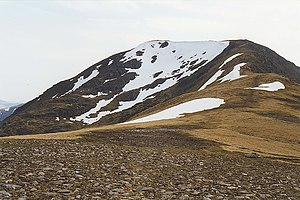
Beinn a' Chreachain is a mountain whose summit marks the border of Argyllshire with Perthshire, and the watershed between the west and east coasts. It has a distinctive conical top, and rises to the north-west of Loch Lyon. Its summit is 3,547 feet above sea level and so it is classified as a Munro.
References
- The Munros, Scottish Mountaineering Trust, 1986, Donald Bennett (Editor) ISBN 0-907521-13-4