Bellingshausen Island: Difference between revisions
Jump to navigation
Jump to search
Created page with '{{Infobox island |name=Bellingshausen Island |territory=South Georgia and the South Sandwich Islands |group=South Sandwich Islands |picture=South sandwich islands.png |picture ca…' |
mNo edit summary |
||
| Line 7: | Line 7: | ||
|map=Thule-Location.JPG | |map=Thule-Location.JPG | ||
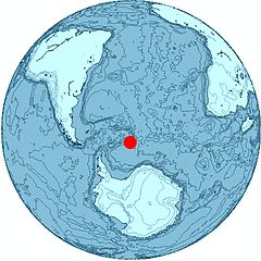
|map caption=Location of Bellingshausen Island | |map caption=Location of Bellingshausen Island | ||
|latitude= | |latitude=-59.4167 | ||
|longitude= | |longitude=-27.05 | ||
|highest point= | |highest point= | ||
|population= | |population= | ||
Revision as of 07:23, 2 August 2014
| Bellingshausen Island | |
|
South Sandwich Islands
| |
|---|---|
 South Sandwich Islands | |
| Location | |
| Location: | 59°25’0"S, 27°3’0"W |
| Data | |
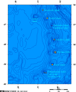
Bellingshausen Island is one of the most southerly of the South Sandwich Islands, forming part of the Southern Thule group and close to Thule Island and Cook Island. It is named after its discoverer, the Baltic German / Russian Antarctic explorer Fabian von Bellingshausen (1778–1852).
The island is a basaltic andesite stratovolcano, and the latest crater, about 500 feet across and 200 feet deep, formed explosively some time between 1968 and 1984.
Outside links
Photographs of the island can be found at:
References
- "Thule Islands" at Global Volcanism Program
- LeMasurier, W. E.; Thomson, J. W. (eds.) (1990). Volcanoes of the Antarctic Plate and Southern Oceans. American Geophysical Union. p. 512 pp. ISBN 0-87590-172-7.
| South Georgia and the South Sandwich Islands | |
|---|---|
| South Georgia: | Annenkov Island • Bird Island • Clerke Rocks • Cooper Island • Grass Island • Kupriyanov Islands • Pickersgill Islands • Saddle Island • Shag Rocks • South Georgia • Welcome Islands • Willis Islands • Trinity Island • Grassholm • Black Rocks • Black Rock |
| South Sandwich Islands: |
Bellingshausen • Bristol • Candlemas • Cook • Leskov • Montagu • Saunders • Thule • Vindication • Visokoi • Zavodovski |
