Llanrhyddlad: Difference between revisions
Jump to navigation
Jump to search
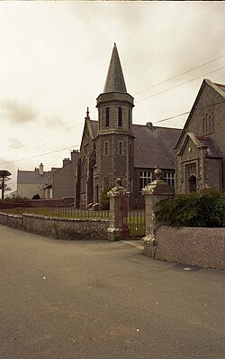
Created page with '{{Infobox town |name=Llanrhyddlad |county=Anglesey |picture=Chapel in Llanrhyddlad - geograph.org.uk - 132974.jpg |os grid ref=SH332891 |latitude=53.372594 |longitude=-4.508155 |…' |
No edit summary |
||
| Line 7: | Line 7: | ||
|longitude=-4.508155 | |longitude=-4.508155 | ||
|population= | |population= | ||
|post town= | |post town=Holyhead | ||
|postcode=LL65 | |postcode=LL65 | ||
|dialling code= | |dialling code= | ||
| Line 13: | Line 13: | ||
|constituency=Ynys Môn | |constituency=Ynys Môn | ||
}} | }} | ||
'''Llanrhyddlad''' is a village | '''Llanrhyddlad''' is a village and parish in the [[Talybolion]] hundred of [[Anglesey]]. | ||
==References== | ==References== | ||
Latest revision as of 13:45, 3 September 2019
| Llanrhyddlad | |
| Anglesey | |
|---|---|

| |
| Location | |
| Grid reference: | SH332891 |
| Location: | 53°22’21"N, 4°30’29"W |
| Data | |
| Post town: | Holyhead |
| Postcode: | LL65 |
| Local Government | |
| Council: | Anglesey |
| Parliamentary constituency: |
Ynys Môn |
Llanrhyddlad is a village and parish in the Talybolion hundred of Anglesey.
References

This Anglesey article is a stub: help to improve Wikishire by building it up.