Broad Down: Difference between revisions
Jump to navigation
Jump to search
Created page with '{{Infobox hill |name=Broad Down |county=Worcestershire |range=Malvern Hills |picture=Broad Down - geograph.org.uk - 447499.jpg |picture caption=Broad Down, looking north to Black…' |
mNo edit summary |
||
| Line 10: | Line 10: | ||
'''Broad Down''' in the [[Malvern Hills]] is a hill of 958 feet mainly on the [[Worcestershire]] side of the hills, forming the south side of the curve of hillsides all around the dip in which the British Camp Reservoir lies. | '''Broad Down''' in the [[Malvern Hills]] is a hill of 958 feet mainly on the [[Worcestershire]] side of the hills, forming the south side of the curve of hillsides all around the dip in which the British Camp Reservoir lies. | ||
Broad Down is south of [[Tinkers Hill]] and north of [[ | Broad Down is south of [[Tinkers Hill]] and north of [[Hangman's Hill]], and southeast of the [[Herefordshire Beacon]] and [[Millennium Hill]]. | ||
On the southwest side of the hill, as it reaches the county boundary, the hillside descends in a sharp escarpment down to the [[News Wood]]. | On the southwest side of the hill, as it reaches the county boundary, the hillside descends in a sharp escarpment down to the [[News Wood]]. | ||
Revision as of 21:40, 29 March 2012
| Broad Down | |||
| Worcestershire | |||
|---|---|---|---|
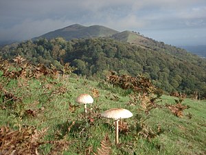
 Broad Down, looking north to Black Hill's two tops | |||
| Range: | Malvern Hills | ||
| Summit: | 958 feet SO762395 | ||
Broad Down in the Malvern Hills is a hill of 958 feet mainly on the Worcestershire side of the hills, forming the south side of the curve of hillsides all around the dip in which the British Camp Reservoir lies.
Broad Down is south of Tinkers Hill and north of Hangman's Hill, and southeast of the Herefordshire Beacon and Millennium Hill.
On the southwest side of the hill, as it reaches the county boundary, the hillside descends in a sharp escarpment down to the News Wood.