Chrishall Common: Difference between revisions
Jump to navigation
Jump to search
Created page with 'right|thumb|350px|Chrishall Common, looking toward High Wood '''Chrishall Common''' in Essex lies between the village…' |
No edit summary |
||
| Line 1: | Line 1: | ||
{{county|Essex}} | |||
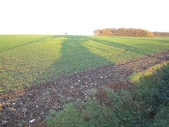
[[File:Chrishall Common - geograph.org.uk - 280699.jpg|right|thumb|350px|Chrishall Common, looking toward High Wood]] | [[File:Chrishall Common - geograph.org.uk - 280699.jpg|right|thumb|350px|Chrishall Common, looking toward High Wood]] | ||
'''Chrishall Common''' in [[Essex]] lies between the villages of [[Chrishall]] and [[Langley, Essex|Langley]]. It contains the High Wood, which is well named as here is found the county's highest point: though the land in the High Wood is fairly flat, the [[county top]] is reckoned at 482 feet above sea level at {{getmapecho|TL4430136202}}. | '''Chrishall Common''' in [[Essex]] lies between the villages of [[Chrishall]] and [[Langley, Essex|Langley]]. It contains the High Wood, which is well named as here is found the county's highest point: though the land in the High Wood is fairly flat, the [[county top]] is reckoned at 482 feet above sea level at {{getmapecho|TL4430136202}}. | ||
| Line 4: | Line 5: | ||
The name is a little misleading: it is not common land these days and not at Chrishall, but north of Langley, south of Chrishall and across the brook. The county top is best reached from Langley Upper Green, behind its delightful church. | The name is a little misleading: it is not common land these days and not at Chrishall, but north of Langley, south of Chrishall and across the brook. The county top is best reached from Langley Upper Green, behind its delightful church. | ||
{{ | ==Outside links== | ||
*Location map: {{wmap|52.0055|0.1009|zoom=14}} | |||
[[Category:County tops]] | [[Category:County tops]] | ||
{{stub}} | |||
Latest revision as of 19:08, 10 March 2018

Chrishall Common in Essex lies between the villages of Chrishall and Langley. It contains the High Wood, which is well named as here is found the county's highest point: though the land in the High Wood is fairly flat, the county top is reckoned at 482 feet above sea level at TL4430136202.
The name is a little misleading: it is not common land these days and not at Chrishall, but north of Langley, south of Chrishall and across the brook. The county top is best reached from Langley Upper Green, behind its delightful church.
Outside links
- Location map: 52°0’20"N, -0°6’3"E

This Essex article is a stub: help to improve Wikishire by building it up.