Port of Menteith: Difference between revisions
No edit summary |
mNo edit summary |
||
| Line 18: | Line 18: | ||
'''Port of Menteith''' is a village and parish in south-western [[Perthshire]], the only significant settlement on the [[Lake of Menteith]]. It was established as a burgh of barony, then named simply Port, in 1457 by King James III. For the most part its southern boundary also forms the county border with [[Stirlingshire]], except where Perthshire reaches further south into the parish of [[Kippen]]. | '''Port of Menteith''' is a village and parish in south-western [[Perthshire]], the only significant settlement on the [[Lake of Menteith]]. It was established as a burgh of barony, then named simply Port, in 1457 by King James III. For the most part its southern boundary also forms the county border with [[Stirlingshire]], except where Perthshire reaches further south into the parish of [[Kippen]]. | ||
The village lies at the north-eastern edge of the Lake, at the junction of the A81 road with the B8034 road, which runs south, just to the west of [[Flanders Moss]], to meet the A811 road at [[Arnprior]]. The elevation is around 80 feet above sea level. The country around is generally low-lying, except to the north where the Menteith Hills rise, including [[Beinn Dearg]], with the [[Trossachs]] and the southern Highlands beyond. The parish includes the outlying settlements of Cobleland, Dykehead, Gartmore and Ruskie. | The village lies at the north-eastern edge of the Lake, at the junction of the A81 road with the B8034 road, which runs south, just to the west of [[Flanders Moss]], to meet the A811 road at [[Arnprior]]. The elevation is around 80 feet above sea level. The country around is generally low-lying, except to the north where the [[Menteith Hills]] rise, including [[Beinn Dearg (Menteith)|Beinn Dearg]], with the [[Trossachs]] and the southern Highlands beyond. The parish includes the outlying settlements of Cobleland, Dykehead, Gartmore and Ruskie. | ||
The parish of Port of Menteith, area 17,855 acres, had a resident population of 768 in the United Kingdom Census 2001, down from 884 in 1991.<ref>[http://www.scrol.gov.uk/scrol/analyser/analyser?topicId=1&tableId=&tableName=Usual+resident+population&selectedTopicId=&aggregated=false&subject=&tableNumber=&selectedLevelId=&postcode=&areaText=&RADIOLAYER=&actionName=view-results&clearAreas=&stateData1=&stateData2=&stateData3=&stateData4=&debug=&tempData1=&tempData2=&tempData3=&tempData4=&areaId=697&levelId=4 SCROL]</ref> | The parish of Port of Menteith, area 17,855 acres, had a resident population of 768 in the United Kingdom Census 2001, down from 884 in 1991.<ref>[http://www.scrol.gov.uk/scrol/analyser/analyser?topicId=1&tableId=&tableName=Usual+resident+population&selectedTopicId=&aggregated=false&subject=&tableNumber=&selectedLevelId=&postcode=&areaText=&RADIOLAYER=&actionName=view-results&clearAreas=&stateData1=&stateData2=&stateData3=&stateData4=&debug=&tempData1=&tempData2=&tempData3=&tempData4=&areaId=697&levelId=4 SCROL]</ref> | ||
Latest revision as of 23:24, 17 January 2017
| Port of Menteith Gaelic: Port Loch Innis Mo Cholmaig | |
| Perthshire | |
|---|---|
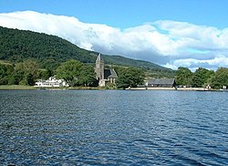
 Looking back from the Lake of Menteith | |
| Location | |
| Location: | 56°11’2"N, 4°17’6"W |
| Data | |
| Population: | 768 |
| Post town: | Stirling |
| Postcode: | FK8 |
| Dialling code: | 01877 |
| Local Government | |
| Council: | Stirling |
| Parliamentary constituency: |
Stirling |
| Website: | http://www.portofmenteith.org.uk/ |
Port of Menteith is a village and parish in south-western Perthshire, the only significant settlement on the Lake of Menteith. It was established as a burgh of barony, then named simply Port, in 1457 by King James III. For the most part its southern boundary also forms the county border with Stirlingshire, except where Perthshire reaches further south into the parish of Kippen.
The village lies at the north-eastern edge of the Lake, at the junction of the A81 road with the B8034 road, which runs south, just to the west of Flanders Moss, to meet the A811 road at Arnprior. The elevation is around 80 feet above sea level. The country around is generally low-lying, except to the north where the Menteith Hills rise, including Beinn Dearg, with the Trossachs and the southern Highlands beyond. The parish includes the outlying settlements of Cobleland, Dykehead, Gartmore and Ruskie.
The parish of Port of Menteith, area 17,855 acres, had a resident population of 768 in the United Kingdom Census 2001, down from 884 in 1991.[1]
In the summer months a ferry runs from Port of Menteith to the island of Inchmahome, site of the Historic Scotland-maintained Inchmahome Priory. The village is home to a fishing club and is the starting point for anglers on the Lake of Menteith. Nick Nairn's cookery school is based at Loch End, just south of Port of Menteith at the south-east corner of the Lake.
Nearby Rednock House is a historic Laird’s House remodelled by the architect Robert Brown of Edinburgh in 1827. Its grounds include a walled garden, ice house and ornamental water garden.
Notes
Outside links
| ("Wikimedia Commons" has material about of Menteith Port of Menteith) |
This Perthshire article is a stub: help to improve Wikishire by building it up.
