Six Mile Water: Difference between revisions
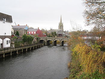
Created page with "right|thumb|350px|Bridge over the Six Mile Water {{county|Antrim}} The '''Six Mile Water''' is a river in southern County Ant..." |
mNo edit summary |
||
| Line 3: | Line 3: | ||
The '''Six Mile Water''' is a river in southern [[County Antrim]]. It was historically called the ''(river) Ollar'' (and is known in the Irish language as ''Abhainn na bhFiodh''.<ref>[http://www.logainm.ie/?text=six+mile+water&placeID=118072 Placenames Database of Ireland]</ref> | The '''Six Mile Water''' is a river in southern [[County Antrim]]. It was historically called the ''(river) Ollar'' (and is known in the Irish language as ''Abhainn na bhFiodh''.<ref>[http://www.logainm.ie/?text=six+mile+water&placeID=118072 Placenames Database of Ireland]</ref> | ||
The Six Mile Water is an indirect tributary of the [[River Bann]], by way of [[Lough Neagh]]. It rises in the hills west of [[Larne]] and north of [[Carrickfergus]] and descends gently westward, flowing through or close to the communities of [[Ballynure]], [[Ballyclare]], [[Doagh]], [[Parkgate, County Antrim|Parkgate]], [[Templepatrick]], [[Dunadry]] and [[ | The Six Mile Water is an indirect tributary of the [[River Bann]], by way of [[Lough Neagh]]. It rises in the hills west of [[Larne]] and north of [[Carrickfergus]] and descends gently westward, flowing through or close to the communities of [[Ballynure]], [[Ballyclare]], [[Doagh]], [[Parkgate, County Antrim|Parkgate]], [[Templepatrick]], [[Dunadry]] and [[Antrim]] into Lough Neagh. A weir exists at Ballyclare where water was diverted to the paper mill. The Six Mile Water Park was constructed around the river in Ballyclare, in order that the river's frequent floods would not affect houses in the area. It has a catchment of 117 square miles. | ||
==Name== | ==Name== | ||
Revision as of 22:13, 16 June 2014

The Six Mile Water is a river in southern County Antrim. It was historically called the (river) Ollar (and is known in the Irish language as Abhainn na bhFiodh.[1]
The Six Mile Water is an indirect tributary of the River Bann, by way of Lough Neagh. It rises in the hills west of Larne and north of Carrickfergus and descends gently westward, flowing through or close to the communities of Ballynure, Ballyclare, Doagh, Parkgate, Templepatrick, Dunadry and Antrim into Lough Neagh. A weir exists at Ballyclare where water was diverted to the paper mill. The Six Mile Water Park was constructed around the river in Ballyclare, in order that the river's frequent floods would not affect houses in the area. It has a catchment of 117 square miles.
Name
While not a mighty torrent of a river, the river is closer to 20 miles long than six. Accounts vary as to the origins of the name. The most widely accepted story is that Norman soldiers marching from Carrickfergus Castle calculated that they had marched six miles when they forded the river at Ballyclare. When the Normans built the castle at Carrickfergus they placed a line of outposts along the river which was then called the Ollar (River of the Rushes). In time the soldiers making the journey from Carrickfergus to Antrim reached the river at this spot when they had travelled six miles and so began to call the Ollar the Six Mile Water.[2]
Angling
The Six Mile Water is famous for its trout fishing. It has brown trout, salmon and dollaghan.
Salmon had virtually disappeared from the river by the early part of the 20th Century. Local anglers, concerned about the poor state of the river, formed the Antrim and District Angling Association in the late 1950s. They identified the main problems as pollution, habitat degradation through drainage works and obstructions, mainly weirs built in the 19th Century for water power to supply the numerous mills in the area. Regulations to control methods of fishing and number of fish caught, together with protection of the river from poaching and pollution enabled native brown trout and dollaghan numbers to improve substantially by the 1970s. By 2004 over 200 salmon were caught by anglers in that year. The run of salmon in 2004 into the river probably exceeded its Conservation Limit for the first time in over 100 years.
Outside links
| ("Wikimedia Commons" has material about Six Mile Water) |
References
- ↑ Placenames Database of Ireland
- ↑ "History of the area". Antrim and District Angling Association. http://www.sixmilewater.co.uk/History.html. Retrieved 28 February 2009.
Coordinates: 54°43′04″N 6°13′52″W / 54.71788°N 6.23122°W
