Lantern Pike: Difference between revisions
Jump to navigation
Jump to search
mNo edit summary |
|||
| Line 18: | Line 18: | ||
==References== | ==References== | ||
{{reflist}} | {{reflist}} | ||
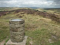
[[File:Toposcope, Lantern Pike - geograph.org.uk - 221318.jpg|left|200px|Toposcope on Lantern Pike]] | [[File:Toposcope, Lantern Pike - geograph.org.uk - 221318.jpg|thumb|left|200px|Toposcope on Lantern Pike]] | ||
[[Category:National Trust properties in Derbyshire]] | [[Category:National Trust properties in Derbyshire]] | ||
Revision as of 20:25, 6 August 2014
| Lantern Pike | |||
| Derbyshire | |||
|---|---|---|---|
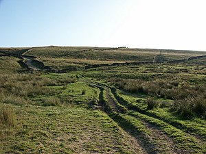
 Moorland on Lantern Pike | |||
| Range: | Peak District | ||
| Summit: | 1,224 feet SK026881 | ||
Lantern Pike is a hill found just outside Hayfield in Derbyshire. The land lies within the Peak District National Park and is owned and maintained by the National Trust. It is permanently open to the public.
The Pike reaches a height of 1,224 feet at its summit, and from here there are fine views in all directions over the High Peak.
The hill is a popular hiking destination, and is often considered a continuation of nearby Kinder Scout, Derbyshire's county top.
According to the Peak District National Park Authority, the name 'Lantern Pike' probably comes from the fact the hill was used as a beacon. The hill gives its name to the Lantern Pike Inn, in nearby Little Hayfield.
References
