Trefor: Difference between revisions
m Created page with '{{Infobox town |name=Trefor |county=Caernarfonshire |picture=Trefor village with north summit of Yr Eifl behind - geograph.org.uk - 92363.jpg |picture caption=Trefor and Yr Eifl …' |
|||
| Line 13: | Line 13: | ||
==The village== | ==The village== | ||
Trefor stands just off the main | Trefor stands just off the main A499 road which runs along the north coast of Llŷn. The village has a small harbour and a sandy beach beside it. There is a shop, a post office and a village school, which named after the town's hills: ''Ysgol yr Eifl''. | ||
The village has a well-stocked children's play area, and there is a pushchair-friendly circular walk from the play area, down to the beach, across the headland and back into the village again. | The village has a well-stocked children's play area, and there is a pushchair-friendly circular walk from the play area, down to the beach, across the headland and back into the village again. | ||
Latest revision as of 20:12, 9 February 2012
| Trefor | |
| Caernarfonshire | |
|---|---|
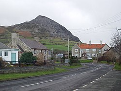
 Trefor and Yr Eifl | |
| Location | |
| Grid reference: | SH372466 |
| Location: | 52°59’35"N, 4°25’12"W |
| Data | |
| Postcode: | LL54 |
| Local Government | |
| Council: | Gwynedd |
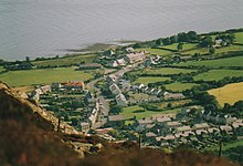
Trefor is a village in Caernarfonshire, on the north coast of the Llŷn peninsula, on a calm beach with the mountains at its back, close by the village of Llanaelhaearn. The 2001 Census recorded the population of Trefor and Llanaelhaearn together as 1,560.
The village
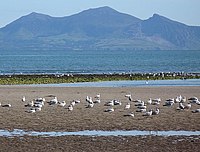
Trefor stands just off the main A499 road which runs along the north coast of Llŷn. The village has a small harbour and a sandy beach beside it. There is a shop, a post office and a village school, which named after the town's hills: Ysgol yr Eifl.
The village has a well-stocked children's play area, and there is a pushchair-friendly circular walk from the play area, down to the beach, across the headland and back into the village again.
There is a small pier next to the harbour, but it has been deemed unsafe so is currently closed to the public.
Yr Eifl


Rising steeply behind the village is Yr Eifl, a range of three high hills which dominate the skyline above Trefor:
- Garn Ganol, the highest at 1,850 feet;
- Tre'r Ceiri, whose summit has one Britain's best examples of a Neolithic settlement;
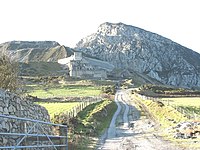
- Garn For, the smallest and most seaward, on which is Trevor Granite Quarry.
From the summit of Tre'r Ceir, views on a clear day, extend to Ireland, the whole of Cardigan Bay, Anglesey, Snowdonia, and even the Lake District.
Since 1850 Trefor Granite Quarry exploited the granite of Garn For, which is used to make curling stones.[1] From 1865 until its closure in 1960, an industrial narrow gauge railway, Trefor Quarry Railway, brought rock from the quarry to the coast.
Big Society
- Football: the village football club was re-established in the 2000–01 season
- Social club: Clwb Y Twr, has pool and darts teams and regularly hosts entertainment.
- Surfing: surfing can be enjoyed beyond the harbour wall at Trefor. Technical experts wil affirm that there can be a nice left hand point over a stony reef thrown off the headland. It holds up well in a southerly wind when the swell wraps around the point.
Outside links
