Start Point, Devon: Difference between revisions
No edit summary |
mNo edit summary |
||
| Line 12: | Line 12: | ||
The Start Point transmitting station is located on top of the promontory, just north-west of the lighthouse. Built in 1939, it nowadays transmits only a single broadcast, BBC Radio 5 Live. | The Start Point transmitting station is located on top of the promontory, just north-west of the lighthouse. Built in 1939, it nowadays transmits only a single broadcast, BBC Radio 5 Live. | ||
Lamacraft Farm | Lamacraft Farm is a short walk from Start Point. | ||
==Seamark== | ==Seamark== | ||
Latest revision as of 21:48, 31 July 2023

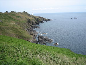
Start Point is a promontory on the south coast of Devon, at around SX832370. It is close to the most southerly point in the county, it marks the southern limit of Start Bay, which extends northwards to the estuary of the River Dart.
The name "Start" derives from the Old English word steort, meaning "tail", a word used of other headlands, as Land's End in recorded in that era as Penwiþsteort.
Features
The rocks of the point are greenschist and mica-schist, formed by metamorphism of Devonian sediments during a period of mountain building towards the end of the Carboniferous period.
As a result of the many shipwrecks in the area, Start Point lighthouse was built in 1836 to alert ships to the danger of the point and its surrounding rocks. The lighthouse, and the area's birdlife, make it a popular spot for visitors, and Start Point is accessible to walkers from the South West Coast Path.
The Start Point transmitting station is located on top of the promontory, just north-west of the lighthouse. Built in 1939, it nowadays transmits only a single broadcast, BBC Radio 5 Live.
Lamacraft Farm is a short walk from Start Point.
Seamark
The headland is prominent to sailors and fishermen leaving Plymouth through Plymouth Sound. It is often the last piece of land they see leaving Britain, and the first they see when returning home; Rame Head thus appears in the sea shanty "Spanish Ladies":
| “ | The first land we sighted was call-ed the Dodman, |
” |
Outside links
- Location map: 50°13’17"N, 3°38’19"W