Template:FP-Glas Maol: Difference between revisions
No edit summary |
No edit summary |
||
| Line 2: | Line 2: | ||
|pic=Western slopes of Glas Maol - geograph.org.uk - 41018.jpg | |pic=Western slopes of Glas Maol - geograph.org.uk - 41018.jpg | ||
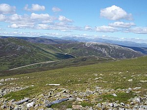
|cap=The Western slopes of Glas Maol | |cap=The Western slopes of Glas Maol | ||
|text='''Glas Maol''' marks the meeting point of three counties: Angus, Aberdeenshire and Perthshire. It is the county top of Angus and the highest point in the Mounth, in the | |text='''Glas Maol''' marks the meeting point of three counties: [[Angus]], [[Aberdeenshire]] and [[Perthshire]]. It is the county top of Angus and the highest point in the Mounth, in the south-eastern part of the Highlands. The mountain's name is Gaelic, meaning "Grey-green hill". | ||
Standing at 3,504 feet above see level, this mountain is classed as a "munro", and one of the more popular ones to climb. It is generally climbed from the highest point of the A93 road between Perth and Braemar, the Cairnwell pass, which is the highest public road in Britain. | Standing at 3,504 feet above see level, this mountain is classed as a "munro", and one of the more popular ones to climb. It is generally climbed from the highest point of the A93 road between Perth and Braemar, the Cairnwell pass, which is the highest public road in Britain. | ||
The summit of Glas Maol is broad and flat with a dry-stone shelter to protect the climber against the viscious winds which tear across it. The western slopes of Glas Maol form part of the Glenshee Ski Centre ski area.}}<noinclude> | The summit of Glas Maol is broad and flat with a dry-stone shelter to protect the climber against the viscious winds which tear across it. The western slopes of Glas Maol form part of the Glenshee Ski Centre ski area.}}<noinclude>{{FP data}} | ||
Latest revision as of 19:49, 6 May 2021
 |
Glas MaolGlas Maol marks the meeting point of three counties: Angus, Aberdeenshire and Perthshire. It is the county top of Angus and the highest point in the Mounth, in the south-eastern part of the Highlands. The mountain's name is Gaelic, meaning "Grey-green hill". Standing at 3,504 feet above see level, this mountain is classed as a "munro", and one of the more popular ones to climb. It is generally climbed from the highest point of the A93 road between Perth and Braemar, the Cairnwell pass, which is the highest public road in Britain. The summit of Glas Maol is broad and flat with a dry-stone shelter to protect the climber against the viscious winds which tear across it. The western slopes of Glas Maol form part of the Glenshee Ski Centre ski area. (Read more) |