Wasdale Pike: Difference between revisions
Jump to navigation
Jump to search
Created page with "{{Infobox hill |name=Wasdale Pike |county=Westmorland |range=Shap Fells |picture=Looking up to Wasdale Pike - geograph.org.uk - 782737.jpg |picture caption=Looking up to Wasda..." |
No edit summary |
||
| Line 1: | Line 1: | ||
{{hatnote|Not to be confused with [[Red Pike (Wasdale)|Wasdale Red Pike]] in Cumberland}} | |||
{{Infobox hill | {{Infobox hill | ||
|name=Wasdale Pike | |name=Wasdale Pike | ||
Latest revision as of 20:47, 2 June 2017
Not to be confused with Wasdale Red Pike in Cumberland
| Wasdale Pike | |||
| Westmorland | |||
|---|---|---|---|
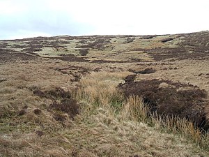
 Looking up to Wasdale Pike | |||
| Range: | Shap Fells | ||
| Summit: | 1,852 feet NY536085 54°28’12"N, 2°43’1"W | ||
Wasdale Pike is a summit of the Shap Fells of Westmorland, on the eastern side of the massif overlooking the broad pass in which the A6 road, the railway and the M6 motorway run.
The Wasdale Beck rises on the slopes of the Pike, at Wasdale Head. The Wasdale Horseshoe, a route devised by Alfred Wainwright, runs over the summit.
References
- Wainwright, Alfred: The Outlying Fells of Lakeland (1974)