River Peffery: Difference between revisions
Created page with "right|thumb|300px|The River Peffry meets the Cromarty Firth {{county|Cromartyshire}} The '''Ri..." |
No edit summary |
||
| Line 10: | Line 10: | ||
About half a mile east of [[Fodderty]], the Peffery enters Ross-shire, just two miles from the sea. It flows through Dingwall and into the Cromarty Firth (through which its course can be traced across the mudflats for a mile at low tide). | About half a mile east of [[Fodderty]], the Peffery enters Ross-shire, just two miles from the sea. It flows through Dingwall and into the Cromarty Firth (through which its course can be traced across the mudflats for a mile at low tide). | ||
[[Category:Rivers of Cromartyshire]] [[Category:Rivers of Ross-shire]] | [[Category:Rivers of Cromartyshire|Peffery]] [[Category:Rivers of Ross-shire|Peffery]] | ||
Latest revision as of 09:13, 27 May 2017

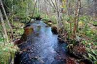
The River Peffery is a short river running through Wester Ross, for the most part within Cromartyshire and in its lower course in Ross-shire. It enters the Cromarty Firth at the latter's county town, Dingwall.
The river rises as the Allt Coire nam Bo Dubha (becoming the Allt Dearg) on the slopes of Cnoc nan Each Mòr, a subsidiary top of Ben Wyvis within one of Cromartyshire's larger parcels, and the stream becomes the Peffery Burn after swallowing a number of other burns off these hills, about where the railway line crosses its course. Soon it reaches Achterneed.

Below Auchterneed, the River Peffery enters the broadening valley known as Strathpeffer, passing to the north of the little town of Strathpeffer.
About half a mile east of Fodderty, the Peffery enters Ross-shire, just two miles from the sea. It flows through Dingwall and into the Cromarty Firth (through which its course can be traced across the mudflats for a mile at low tide).