Ballygalley: Difference between revisions
Created page with '{{Infobox town |name=Ballygalley |county=Antrim |picture= |picture caption= |os grid ref=D3707 |LG district=Larne }} '''Ballygalley''' is a village in County Antrim. {{stub}…' |
No edit summary |
||
| Line 2: | Line 2: | ||
|name=Ballygalley | |name=Ballygalley | ||
|county=Antrim | |county=Antrim | ||
|picture= | |picture=Ballygally - geograph.org.uk - 474677.jpg | ||
|picture caption= | |picture caption=Ballygally beach and Ballygally Head | ||
|os grid ref= | |os grid ref=D373074 | ||
|LG district= | |latitude=54.895872 | ||
|longitude=-5.8598716 | |||
|population= | |||
|census year= | |||
|post town= | |||
|postcode= | |||
|dialling code= | |||
|LG district=Mid and East Antrim | |||
|constituency= | |||
}} | }} | ||
'''Ballygalley''' is a village | '''Ballygalley''' or '''Ballygally''' is a village and holiday resort on the coast of [[County Antrim]], some three miles north of [[Larne]]. It is also a [[townland]] of 769 acres, in the barony of [[Glenarm Upper]]. The 2001 Census recorded a population of 714. | ||
{{ | The name of the village is from the Irish ''Baile Geithligh'', meaning "Geithleach's townland". | ||
==Archaeology== | |||
In the 1990s archaeological excavations were carried out in Ballygally and remains of a number of Neolithic houses on low ground about 500 yards from the shore of Ballygally Bay were discovered. [[Ballygalley Neolithic site]] produced a large number of finds, including pottery, worked [[flint]]s and stone axes and is an important Neolithic site.<ref>{{cite book |author1=O'Sullivan, Aidan |author2=Breen, Colin |lastauthoramp=yes | year=2007 |title=Maritime Ireland. An Archaeology of Coastal Communities | publisher=Tempus | location=Stroud | page=65 |isbn=978-0-7524-2509-2}}</ref> | |||
==About the village== | |||
[[File:Ballygally Head near Larne - geograph.org.uk - 324150.jpg|right|thumb|200px|Ballygally Head]] | |||
Notable features include the distinct headland of Ballygally Head, O'Haloran's Castle, The White Bear Rock, a lovely sandy beach, Ballygally Castle and Ballygally Hall, which opened in 2011. | |||
Ballygally beach is a popular destination for locals and tourists alike especially during the summer months. | |||
[[Ballygally Castle]], reputed to be the oldest occupied building in [[Ireland]], stands in the middle of the village, at the junction with the road to [[Carncastle]]. (Inevitably, it has attracted ghost stories.) The castle contains a 4-star hotel with renovated bar and restaurant. The castle was built around 1625 for James Shaw of [[Greenock]] and is one of Ireland’s best-preserved Scottish baronial style plantation houses. | |||
[[File:Coast Road with Ballygally Castle Hotel - geograph.org.uk - 925365.jpg|right|thumb|200px|Ballygally Castle Hotel]] | |||
The bawn and walled garden ({{map|D37250781}}) are registered as Scheduled Historic Monuments. | |||
Ballygally Hall is a two-storey building (funded by taxpayers’ money) opened in 2011 and includes a Spar shop with some Post Office facilities at ground level and a Community Hall on the first floor. The shop and restaurant, which previously existed on this site, were demolished in 2008, The Community Hall has weekly events and social activities throughout the year. | |||
Cairndhu Golf Course, on top of Ballygally Head, overlooks the village and Carnfunnock Country Park (which offers a cafe, walled garden, caravan park and campsite, maze, children's playground, bouncy castle, mini-train rides, bungee runs, mini-golf, nature walks and lots more family fun) is nearby. | |||
[[File:Ballygally Bay near Larne - geograph.org.uk - 428954.jpg|right|thumb|200px|Ballygally Bay and Scawt Hill]] | |||
==Geology== | |||
Ballygally Head is a volcanic plug, the ancient cooled remains of the pipe of a volcano.<ref name=hmso>Wilson, H E et al (1986) Geological Survey of Northern Ireland, HMSO</ref> | |||
Wedges of agglomerate have been found around Ballygally Head, showing that there were several stages of eruption, allowing tuff to form before the vent was blown out and once more filled with magma.<ref name=hmso/> There are tall columns in places around Ballygally Head, similar to the basalt columns found at the [[Giant's Causeway]], but these are dolerite, a rock similar to basalt but which cooled more slowly, held inside the volcano vent, and so had time to grow larger crystals.<ref name="gia">[http://www.geographyinaction.co.uk/Geology%20files/Dolerite.html Geography in Action, Dolerite, Northern Ireland]</ref> | |||
[[Scawt Hill]], another volcanic plug, three miles west of Ballygally, is an internationally important site for geology due to the rare minerals found there. It is a protected Area of Special Scientific Interest. | |||
==Outside links== | |||
*[http://www.ballygally.co.uk Ballygally Community Development Association] | |||
*[http://www.beachni.com/beaches/ballygally-beach/ Beach NI Details on Ballygally Beach] | |||
*[http://www.hastingshotels.com/ballygally-castle/ Ballygally Castle Hotel] | |||
*[http://www.ballygallyapartments.com/ Ballygally Holiday Apartments] | |||
*[http://www.thehalfwayhousehotel.com Halfway House Hotel] | |||
*[http://matties.co.uk Matties Meeting House] | |||
*[http://www.cairndhugolfclub.co.uk Cairndhu Golf Club] | |||
==References== | |||
{{reflist}} | |||
Latest revision as of 12:57, 27 October 2017
| Ballygalley | |
| County Antrim | |
|---|---|
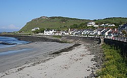
 Ballygally beach and Ballygally Head | |
| Location | |
| Grid reference: | D373074 |
| Location: | 54°53’45"N, 5°51’36"W |
| Data | |
| Local Government | |
| Council: | Mid & East Antrim |
Ballygalley or Ballygally is a village and holiday resort on the coast of County Antrim, some three miles north of Larne. It is also a townland of 769 acres, in the barony of Glenarm Upper. The 2001 Census recorded a population of 714.
The name of the village is from the Irish Baile Geithligh, meaning "Geithleach's townland".
Archaeology
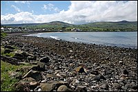
In the 1990s archaeological excavations were carried out in Ballygally and remains of a number of Neolithic houses on low ground about 500 yards from the shore of Ballygally Bay were discovered. Ballygalley Neolithic site produced a large number of finds, including pottery, worked flints and stone axes and is an important Neolithic site.[1]
About the village

Notable features include the distinct headland of Ballygally Head, O'Haloran's Castle, The White Bear Rock, a lovely sandy beach, Ballygally Castle and Ballygally Hall, which opened in 2011.
Ballygally beach is a popular destination for locals and tourists alike especially during the summer months.
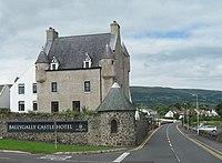
Ballygally Castle, reputed to be the oldest occupied building in Ireland, stands in the middle of the village, at the junction with the road to Carncastle. (Inevitably, it has attracted ghost stories.) The castle contains a 4-star hotel with renovated bar and restaurant. The castle was built around 1625 for James Shaw of Greenock and is one of Ireland’s best-preserved Scottish baronial style plantation houses.

The bawn and walled garden (D37250781) are registered as Scheduled Historic Monuments.
Ballygally Hall is a two-storey building (funded by taxpayers’ money) opened in 2011 and includes a Spar shop with some Post Office facilities at ground level and a Community Hall on the first floor. The shop and restaurant, which previously existed on this site, were demolished in 2008, The Community Hall has weekly events and social activities throughout the year.
Cairndhu Golf Course, on top of Ballygally Head, overlooks the village and Carnfunnock Country Park (which offers a cafe, walled garden, caravan park and campsite, maze, children's playground, bouncy castle, mini-train rides, bungee runs, mini-golf, nature walks and lots more family fun) is nearby.

Geology
Ballygally Head is a volcanic plug, the ancient cooled remains of the pipe of a volcano.[2]
Wedges of agglomerate have been found around Ballygally Head, showing that there were several stages of eruption, allowing tuff to form before the vent was blown out and once more filled with magma.[2] There are tall columns in places around Ballygally Head, similar to the basalt columns found at the Giant's Causeway, but these are dolerite, a rock similar to basalt but which cooled more slowly, held inside the volcano vent, and so had time to grow larger crystals.[3]
Scawt Hill, another volcanic plug, three miles west of Ballygally, is an internationally important site for geology due to the rare minerals found there. It is a protected Area of Special Scientific Interest.
Outside links
- Ballygally Community Development Association
- Beach NI Details on Ballygally Beach
- Ballygally Castle Hotel
- Ballygally Holiday Apartments
- Halfway House Hotel
- Matties Meeting House
- Cairndhu Golf Club
References
- ↑ O'Sullivan, Aidan & Breen, Colin (2007). Maritime Ireland. An Archaeology of Coastal Communities. Stroud: Tempus. p. 65. ISBN 978-0-7524-2509-2.
- ↑ 2.0 2.1 Wilson, H E et al (1986) Geological Survey of Northern Ireland, HMSO
- ↑ Geography in Action, Dolerite, Northern Ireland