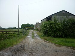
Difference between revisions of "Land of Nod, Yorkshire"
From Wikishire
(Created page with "{{Infobox town |name=Land of Nod |county=Yorkshire |riding=East |picture=Land of Nod, off Lock Lane - geograph.org.uk - 2466437.jpg |picture caption=Land of Nod |os grid ref=S...") |
(No difference)
|
Latest revision as of 20:19, 29 August 2023
| Land of Nod | |
| Yorkshire East Riding | |
|---|---|
 Land of Nod | |
| Location | |
| Grid reference: | SE842365 |
| Location: | 53°49’7"N, 0°43’17"W |
| Data | |
| Local Government | |
| Council: | East Riding of Yorkshire |
Land of Nod is hamlet in the East Riding of Yorkshire, standing at the far end of a two-mile-long road, which joins the A614 road at Holme-on-Spalding-Moor
References
- Crowther, Bruce (1991) (in en). Yesterday's Yorkshire. David & Charles. p. 118. ISBN 9780715394717. https://books.google.com/books?id=c7nyAAAAMAAJ&q=%22land+of+nod%22. Retrieved 8 July 2017.