Glen Douglas: Difference between revisions
Created page with "right|thumb|320px|The Douglas Water in the glen File:Glen Douglas - geograph.org.uk - 623476.jpg|right|thumb|230px|The s..." |
No edit summary |
||
| Line 16: | Line 16: | ||
{{reflist}} | {{reflist}} | ||
[[Category:Glens of Dunbartonshire]] | [[Category:Glens of Dunbartonshire|Douglas]] | ||
Latest revision as of 09:54, 16 April 2022


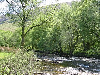
Glen Douglas is a glen in north-western Dunbartonshire, carved through the Luss Hills by the Douglas Water, which discharges at the village of Inverbeg at its eastern end into Loch Lomond. The glen is followed by a single-track road which links the A82 road alongside Loch Lomond with the A814 road beside Loch Long.
To the north and south of the glen rise the Luss Hills: to the north it is overlooked by Beinn Bhreac (2,234 feet) and Tullich Hill (2,073 feet). To the south are the highest mountain of the range, Doune Hill (2,408 feet), as well as a Coire na h-Eanachan at 2,149 feet.
At the upper (western) end of the glen is the DM Glen Douglas military munitions depot which is connected to the railway line from Helensburgh to Crianlarich at the site of the old station, Glen Douglas Halt.
Glen Douglas has three farms, two of which are still worked, both of which are named after hills above the Glen: Doune Farm and Tullich Farm.
Location
- Location map: 56°8’60"N, 4°43’12"W