Mangerton River: Difference between revisions
Jump to navigation
Jump to search
No edit summary |
Fixing typo: ands → and |
||
| (One intermediate revision by one other user not shown) | |||
| Line 1: | Line 1: | ||
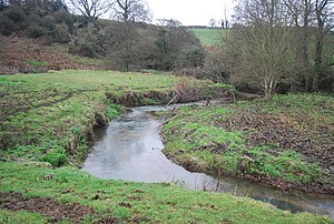
[[File:Mangerton River, Dorset - geograph-2889907.jpg|right|thumb|300px|The Mangerton River below Mangerton]] | [[File:Mangerton River, Dorset - geograph-2889907.jpg|right|thumb|300px|The Mangerton River below Mangerton]] | ||
{{county|Dorset}} | {{county|Dorset}} | ||
The '''Mangerton River''' is a river of south-western [[Dorset]]. It rises on Powerstock Common, above [[Powerstock]], | The '''Mangerton River''' is a river of south-western [[Dorset]]. It rises on Powerstock Common, above [[Powerstock]], and flows westward to [[Mangerton, Dorset|Mangerton]], where it once powered the historic [[Mangerton Mill]]. | ||
From here the river turns south to join the [[River Asker]] at [[Bradpole]] on the edge of [[Bridport]]: the united stream goes on to join the [[River Brit]], just below the town centre to finish the short distance to the sea at [[West Bay, Dorset|West Bay]]. | From here the river turns south to join the [[River Asker]] at [[Bradpole]] on the edge of [[Bridport]]: the united stream goes on to join the [[River Brit]], just below the town centre to finish the short distance to the sea at [[West Bay, Dorset|West Bay]]. | ||
Latest revision as of 02:30, 22 July 2021

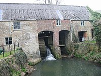
The Mangerton River is a river of south-western Dorset. It rises on Powerstock Common, above Powerstock, and flows westward to Mangerton, where it once powered the historic Mangerton Mill.
From here the river turns south to join the River Asker at Bradpole on the edge of Bridport: the united stream goes on to join the River Brit, just below the town centre to finish the short distance to the sea at West Bay.
Location
- Location map: 50°45’30"N, 2°43’33"W
