Shutlingsloe: Difference between revisions
Created page with "{{Infobox hill |name=Shutlingsloe |county=Cheshire |picture=Shutlingsloe.jpg |picture caption=Shutlingsloe from the Macclesfield Forest path |os grid ref=SJ976695 |latitude=53..." |
No edit summary |
||
| Line 10: | Line 10: | ||
|height=1,660 feet | |height=1,660 feet | ||
}} | }} | ||
'''Shutlingsloe''' is a hill near the village of [[Wildboarclough]], in the east of [[Cheshire]], and on the edge of the [[Peak District]]. It stands to the south of [[Macclesfield Forest]], and within the Peak District National Park.<ref name=pdf>[http://www.cheshire.gov.uk/NR/rdonlyres/23D5A37C-5923-4A13-8DD8-77436902FBFD/0/LCA_Atype_20_moorland_plateau.pdf Cheshire County Council: Landscape Character Type 20: Moorland Plateau (2007)</ref> | '''Shutlingsloe''' is a hill near the village of [[Wildboarclough]], in the east of [[Cheshire]], and on the edge of the [[Peak District]]. It stands to the south of [[Macclesfield Forest]], and within the Peak District National Park.<ref name=pdf>[http://www.cheshire.gov.uk/NR/rdonlyres/23D5A37C-5923-4A13-8DD8-77436902FBFD/0/LCA_Atype_20_moorland_plateau.pdf Cheshire County Council: Landscape Character Type 20: Moorland Plateau] (2007)</ref> | ||
This is a steep-sided hill with a distinctive profile,<ref name=pdf /> sometimes described as the 'Matterhorn of Cheshire', it is the third highest peak in the county (exceeded only by [[Black Hill (Peak District)|Black Hill]] and [[Shining Tor]]) with an elevation of 1,660 feet above sea level, commanding excellent views over Cheshire. | This is a steep-sided hill with a distinctive profile,<ref name=pdf /> sometimes described as the 'Matterhorn of Cheshire', it is the third highest peak in the county (exceeded only by [[Black Hill (Peak District)|Black Hill]] and [[Shining Tor]]) with an elevation of 1,660 feet above sea level, commanding excellent views over Cheshire. | ||
The [[Peak District Boundary Walk]] crosses the summit, and this is the highest point on the footpath's 200-mile long route.<ref | The [[Peak District Boundary Walk]] crosses the summit, and this is the highest point on the footpath's 200-mile long route.<ref>{{Cite book|last=McCloy|first=Andrew|title=Peak District Boundary Walk: 190 Miles Around the Edge of the National Park|publisher=Friends of the Peak District|year=2017|isbn=978-1909461536}}</ref> | ||
The name of the hill derives from old English 'Scyttel's hlaw' meaning 'Scyttel's (personal name) hill'.<ref>Mcmeeken, L. 'Peak Place-names', Halsgrove 2003</ref> | The name of the hill derives from old English 'Scyttel's hlaw' meaning 'Scyttel's (personal name) hill'.<ref>Mcmeeken, L. 'Peak Place-names', Halsgrove 2003</ref> | ||
Latest revision as of 12:22, 6 July 2021
| Shutlingsloe | |||
| Cheshire | |||
|---|---|---|---|
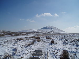
 Shutlingsloe from the Macclesfield Forest path | |||
| Range: | Peak District | ||
| Summit: | 1,660 feet SJ976695 53°13’24"N, 2°2’12"W | ||
Shutlingsloe is a hill near the village of Wildboarclough, in the east of Cheshire, and on the edge of the Peak District. It stands to the south of Macclesfield Forest, and within the Peak District National Park.[1]
This is a steep-sided hill with a distinctive profile,[1] sometimes described as the 'Matterhorn of Cheshire', it is the third highest peak in the county (exceeded only by Black Hill and Shining Tor) with an elevation of 1,660 feet above sea level, commanding excellent views over Cheshire.
The Peak District Boundary Walk crosses the summit, and this is the highest point on the footpath's 200-mile long route.[2]
The name of the hill derives from old English 'Scyttel's hlaw' meaning 'Scyttel's (personal name) hill'.[3]
Geology
The hill is formed from alternating layers of mudstones and coarse sandstones (referred to as 'gritstones' or simply 'grits') which were laid down in a delta system in the Carboniferous period. The summit tor is formed from the Chatsworth Grit and the lower slopes from the Roaches Grit. Several geological faults run northwest to southeast through the hill.[4]
Outside links
| ("Wikimedia Commons" has material about Shutlingsloe) |
References
- ↑ 1.0 1.1 Cheshire County Council: Landscape Character Type 20: Moorland Plateau (2007)
- ↑ McCloy, Andrew (2017). Peak District Boundary Walk: 190 Miles Around the Edge of the National Park. Friends of the Peak District. ISBN 978-1909461536.
- ↑ Mcmeeken, L. 'Peak Place-names', Halsgrove 2003
- ↑ British Geological Survey 1:50,000 map sheet 111 'Buxton' and associated memoir
