Ruthven, Angus: Difference between revisions
Jump to navigation
Jump to search
mNo edit summary |
No edit summary |
||
| Line 15: | Line 15: | ||
|constituency=Angus | |constituency=Angus | ||
}} | }} | ||
'''Ruthven''' (pronounced {{IPA|'''rɪ'''vɨn}}) is a village in [[Angus]]. It is to be found two miles north of [[Meigle]] | '''Ruthven''' (pronounced {{IPA|'''rɪ'''vɨn}}) is a village and parish in [[Angus]] adjacent to the border with [[Perthshire]]. It is to be found two miles north of [[Meigle]] in the latter county, where the A926 road crosses the [[River Isla, Angus|River Isla]]. It is situated to the north side of the vale of Strathmore, near the base of the [[Grampian Mountains|Grampian hills]] and is about two miles in length and nearly of equal breadth. The total area is 2,087 acres. | ||
This parish was for many generations the seat of the Crichton family until becoming extinct in 1742. There are but few remains of their ancient baronial castle. | |||
==References== | ==References== | ||
{{reflist}} | {{reflist}} | ||
{{stub}} | {{stub}} | ||
Latest revision as of 15:18, 7 October 2015
| Ruthven | |
| Angus | |
|---|---|
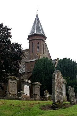
 Ruthven Kirk | |
| Location | |
| Grid reference: | NO288488 |
| Location: | 56°37’32"N, 3°9’43"W |
| Data | |
| Post town: | Forfar |
| Postcode: | DD8 |
| Dialling code: | 01307 |
| Local Government | |
| Council: | Angus |
| Parliamentary constituency: |
Angus |
Ruthven (pronounced rɪvɨn) is a village and parish in Angus adjacent to the border with Perthshire. It is to be found two miles north of Meigle in the latter county, where the A926 road crosses the River Isla. It is situated to the north side of the vale of Strathmore, near the base of the Grampian hills and is about two miles in length and nearly of equal breadth. The total area is 2,087 acres.
This parish was for many generations the seat of the Crichton family until becoming extinct in 1742. There are but few remains of their ancient baronial castle.
References
This Angus article is a stub: help to improve Wikishire by building it up.