Abbey River: Difference between revisions
Jump to navigation
Jump to search
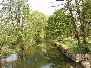
Created page with 'right|thumb|300px|Abbey River north of the Abbey site The '''Abbey River''' is a backwater of the River Thames in England, near Chertsey…' |
No edit summary |
||
| (3 intermediate revisions by one other user not shown) | |||
| Line 1: | Line 1: | ||
[[File:Abbey River Chertsey.jpg|right|thumb|300px|Abbey River north of the Abbey site]] | [[File:Abbey River Chertsey.jpg|right|thumb|300px|Abbey River north of the Abbey site]] | ||
The '''Abbey River''' is a backwater of the [[River Thames]] | The '''Abbey River''' is a backwater of the [[River Thames]], near [[Chertsey]], [[Surrey]]. It runs from behind [[Penton Hook Island]] to below Chertsey Lock. | ||
The river, which was also known as Oxley Mill River was probably cut by the monks of Chertsey Abbey in the eleventh century to supply their mill. In 1608 there were two watermills on the river known as the Oaklake Mylles. In 1809 the millers offered the stream as the main navigation channel but the [[City of London Corporation]] had already decided to build the lock at Chertsey.<ref>Fred. S. Thacker ''The Thames Highway: Volume II Locks and Weirs'' 1920 - republished 1968 David & Charles</ref> | The river, which was also known as Oxley Mill River was probably cut by the monks of Chertsey Abbey in the eleventh century to supply their mill. In 1608 there were two watermills on the river known as the Oaklake Mylles. In 1809 the millers offered the stream as the main navigation channel but the [[City of London|Corporation of London]] had already decided to build the lock at Chertsey.<ref>Fred. S. Thacker ''The Thames Highway: Volume II Locks and Weirs'' 1920 - republished 1968 David & Charles</ref> | ||
==References== | ==References== | ||
{{Reflist}} | {{Reflist}} | ||
[[Category:Rivers of Surrey]] [[Category: | [[Category:Rivers of Surrey]] [[Category:Backwaters of the River Thames]] | ||
Latest revision as of 19:23, 25 August 2015

The Abbey River is a backwater of the River Thames, near Chertsey, Surrey. It runs from behind Penton Hook Island to below Chertsey Lock.
The river, which was also known as Oxley Mill River was probably cut by the monks of Chertsey Abbey in the eleventh century to supply their mill. In 1608 there were two watermills on the river known as the Oaklake Mylles. In 1809 the millers offered the stream as the main navigation channel but the Corporation of London had already decided to build the lock at Chertsey.[1]
References
- ↑ Fred. S. Thacker The Thames Highway: Volume II Locks and Weirs 1920 - republished 1968 David & Charles