Stromay
| Stromay Gaelic: Sròmaigh | |
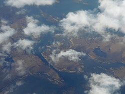
 Stromay from the air | |
|---|---|
| Location | |
| Location: | 57°39’25"N, 7°8’17"W |
| Grid reference: | NF936746 |
| Area: | approx 163 acres |
| Highest point: | 52 feet |
| Data | |
| Population: | 0 |
Stromay is a tidal island off North Uist in the Sound of Harris, within the Outer Hebrides.
The name of the island is from the Old Norse Straum-ey, meaning 'Island in the tidal stream'. Along with its neighbours, the island belongs to Inverness-shire.
A low-lying island, Stromay lies between two wide, shallow sea lochs, Loch Mhic Phàil and Loch Aulasary.[1] Stromay is joined to North Uist for most of the tidal cycle. Stromay from the airA smaller islet of the same name lies between Harris and Ensay,[2] and another (Stròmaigh) between North Uist and Kirkibost.
There are extensive sands and rocks offshore that are exposed at low tide.[3]
References
- ↑ J.D. Hansom. "Loch Maddy - Sound Of Harris Coastline" (PDF). JNCC. http://www.jncc.gov.uk/pdf/gcrdb/GCRsiteaccount2030.pdf. Retrieved 2009-08-12.
- ↑ Haswell-Smith, Hamish (2004). The Scottish Islands. Edinburgh: Canongate. ISBN 1841954543.
- ↑ Rick Livingstone’s Tables provide an area of 100 ha, which may include the inter-tidal zone. Rick Livingstone’s Tables of the Islands of Scotland (pdf) - Argyll Yacht Charters
| The islands of the Sound of Harris, Inverness-shire | ||
|---|---|---|
| Harris |
Berneray • Boreray • Keallasay More • Ensay • Gilsay • Groay • Hermetray • Killegray • Opsay • Pabbay • Sgarabhaigh • Shillay • Stromay • Sursay • Tahay • |
North Uist
|