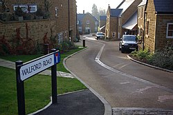
Sibford Ferris
| Sibford Ferris | |
| Oxfordshire | |
|---|---|
 Sibford Ferris | |
| Location | |
| Grid reference: | SP357374 |
| Location: | 52°2’2"N, 1°28’48"W |
| Data | |
| Population: | 476 (2011) |
| Post town: | Banbury |
| Postcode: | OX15 |
| Dialling code: | 01295 |
| Local Government | |
| Council: | Cherwell |
| Parliamentary constituency: |
Banbury |
| Website: | thesibfords.org.uk |
Sibford Ferris is a village in Oxfordshire, six and a half miles west of Banbury and on the south side of the Sib valley opposite its larger sister village, Sibford Gower.
A shop and sub-post office in Sibford Ferris serves all three villages of the parish: Sibford Ferris, Sibford Gower and Burdrop.
The 2011 Census recorded the parish's population as 476.
History and heritage
Sibford Ferris was part of the parish of Swalcliffe until 1841, when a new ecclesiastical parish of Sibford Gower, with Sibford Ferris and Burdrop was created. The parish church, Holy Trinity in Burdrop, was built in 1840 to serve the new parish.[1]
Sibford Ferris Manor House was built in the 17th century and remodelled in the 18th century.[2] In 1842 the Society of Friends extended the house and converted it into a boarding school,[2] Sibford School.[3][4] In the 1930s the main part of the school relocated to buildings south of the village. In the early 2000s the manor was sold for private housing. [citation needed]
There is a water mill on the Sib stream at Temple Mill Farm about a mile south-west of the village, built in 1830.[5]
Home Close[2] was designed and built in traditional Cotswold style by the Arts and Crafts movement architect M. H. Baillie Scott in 1911.
Outside links
| ("Wikimedia Commons" has material about Sibford Ferris) |
References
- ↑ Crossley 1972, pp. 225–260.
- ↑ 2.0 2.1 2.2 Sherwood & Pevsner 1974, p. 767.
- ↑ National Heritage List 1300140: Sibford School (Grade II listing)
- ↑ Sibford School
- ↑ National Heritage List 1390652: Mill at Temple Mill Farm (Grade II listing)
- A History of the County of Oxford - Volume 10 pp 225-260: Parishes: Swalcliffe (Victoria County History)
- Nikolaus Pevsner: The Buildings of England: Oxfordshire, 1974 Penguin Books ISBN 978-0-300-09639-2page 766
This Oxfordshire article is a stub: help to improve Wikishire by building it up.