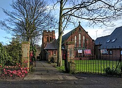
Pleasleyhill
| Pleasleyhill | |
| Nottinghamshire | |
|---|---|
 St Barnabas, Pleasley Hill | |
| Location | |
| Grid reference: | SK507639 |
| Location: | 53°10’14"N, 1°14’30"W |
| Data | |
| Postcode: | NG19 |
| Local Government | |
| Council: | Mansfield |
Pleasleyhill, otherwise called Pleasley Hill is a village of Nottinghamshire which forms a south-eastward extension of Pleasley, the latter in Derbyshire. Pleasley and Pleasleyhill are separated by the River Meden, which is also the county border.
This village once consisted of rows of derelict terraced houses running along the main A617 road leading from Glapwell and the Pleasley By-pass towards Mansfield. These were the subject of lengthy debate in the area, and were demolished in 2013. In 2015, new houses were built on the land.

A small amount of housing regeneration was created by seven derelict terraced homes on Hillmoor Street being sold by the local council to a social enterprise group named TREES for just one pound. (TREES, its name an acronym for 'Training, Regeneration, Education, Employment and Sustainability) is a project administered by an ex-servicemen's charity, Joint Forces Alliance Ltd, which helps old soldiers to refurbish and ultimately live in the homes.[1]