Pattishall
| Pattishall | |
| Northamptonshire | |
|---|---|
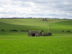
 Fields between Pattishall and Bugbrooke | |
| Location | |
| Grid reference: | SP671542 |
| Location: | 52°10’57"N, 1°1’9"W |
| Data | |
| Population: | 1,471 (2011) |
| Post town: | Towcester |
| Postcode: | NN12 |
| Dialling code: | 01327 |
| Local Government | |
| Council: | West Northamptonshire |
| Parliamentary constituency: |
South Northamptonshire |
Pattishall, also known in antiquity as Pateshull,[1] is a village in Northamptonshire. It is a small village, some four miles from Towcester and seven miles south of Northampton, or eight miles from Wootton and three miles from Bugbrooke.
The village is surrounded by hilly fields and contains both 20th century housing and an older part of the village which is down a hill. It stands adjacent to a Roman road, Watling Street (now the A5) and to Banbury Lane, an ancient drove way.
The population of the civil parish (including Astcote, Dalscote and Eastcote) was 1,471 at the 2011 census.
The village has a church, a park and a working farm.
Church
The parish church, All Saints, dates from the 11th century. It comprises a nave with two side aisles, tower, chancel and vestry, the latter being added around 1870. The tower houses 6 bells and is closed off from the body of the church.[2] The church is a Grade II* listed building.[3]
History

Pattishall appears in the Domesday Book of 1086 as Pascella The name may be from the Old English Pættles hyll for 'Pættel's hill'.[2]
The Patishall family were prominent locally: three of the family were eminent judges during the 13th century, including one, Simon of Pattishall, who drafted Magna Carta.
Pattishall was host to a prisoner-of-war camp during First World War, which housed 4,500 Germans.[4]
Sport
Outside links
| ("Wikimedia Commons" has material about Pattishall) |
References
- ↑ GB Historical GIS / University of Portsmouth, History of Pattishall in South Northamptonshire | Map and description, A Vision of Britain through Time., quoting John Marius Wilson's Imperial Gazetteer of England and Wales (1870-72).
- ↑ 2.0 2.1 All Saints, Pattishall: A Church Near You
- ↑ National Heritage List : Church of All Saints (Grade I* listing)
- ↑ BBC - First World War At Home, Pattishall, Northamptonshire Retrieved 11 July 2018
- ↑ "Pattishall Cricket Club". Pattishall CC. https://pattishall.play-cricket.com/Aboutus. Retrieved 2021-11-18.
- ↑ "Cornhill Squash Club". Pattishall Parish Council. https://www.pattishallparish.org.uk/home/groups-and-organisations/cornhill-squash-club/. Retrieved 2021-11-18.