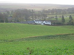
Nine Mile Burn
Jump to navigation
Jump to search
| Nine Mile Burn | |
| Midlothian | |
|---|---|
 Nine Mile Burn | |
| Location | |
| Grid reference: | NT175576 |
| Location: | 55°48’18"N, 3°19’1"W |
| Data | |
| Post town: | Penicuik |
| Postcode: | EH26 |
| Dialling code: | 01968 |
| Local Government | |
| Council: | Midlothian |
| Parliamentary constituency: |
Midlothian |
Nine Mile Burn is a hamlet in Midlothian, in the Pentland Hills, on the A702 road towards West Linton.
The village is about a mile northeast of the village of Carlops, and is in the parish of Penicuik.
Outside links
| ("Wikimedia Commons" has material about Nine Mile Burn) |