Hemsby
| Hemsby | |
| Norfolk | |
|---|---|
 Beach Road, Hemsby | |
| Location | |
| Grid reference: | TG495175 |
| Location: | 52°41’52"N, 1°41’28"E |
| Data | |
| Population: | 3,275 (2011) |
| Post town: | Great Yarmouth |
| Postcode: | NR29 |
| Dialling code: | 01493 |
| Local Government | |
| Council: | Great Yarmouth |
| Parliamentary constituency: |
Great Yarmouth |
Hemsby is a seaside village in Norfolk, found eight miles north-west of Great Yarmouth. It borders the villages of Winterton-on-Sea and Scratby.
The 2011 Census recorded Hemsby's parish population as 3,275.
Coastal erosion is destroying a number of homes[1] and others are threatened. A Norfolk county map dated around 1610 shows a headland, called Winterton Ness, extending into the sea north-east of Hemsby. This headland has now almost entirely disappeared through erosion.
The village's name means 'Hemer's farm/settlement'.
The Domesday Book of 1086 names under the name of Haimesbei with a description of "a hamlet covering 43 meadow acres with 50 households, 3 slaves, 2 salt pans and 160 sheep".
The village
Beaches
In late February 2023, the beaches experienced another bout of severe erosion. Access became so limited the lifeboat was unable to launch.
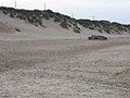
The beaches were one of the major tourist draws in the village, with miles of sandy coastline. Large sand dunes form a natural barrier between the beach and the village behind it. One of the more unusual features of the beach is a scattering of anti-tank blocks across the beach, and a concrete bunker, left over from the Second World War coastline defences. These were cast by the Royal Engineers as tank defences.
Erosion is a major problem in the surrounding villages of Winterton-on-Sea and Caister where sandy cliffs are being destroyed by the forces of the sea. Hemsby's dunes are also being eroded; previously the wide beach had made the effect less noticeable.
Hemsby Village
Hemsby is split into two parts: Hemsby Village and Hemsby Beach. Hemsby Village is mainly the residential area, about a mile inland. Kingsway is an area of the village which includes a Co-op shop, hairdressers and a Chinese restaurant. This is also the main location for buses into Great Yarmouth and Martham. St Mary the Virgin Church was built in the 12th century and is a landmark in the village.
The Scroby Sands wind farm was built in 2003 and is clearly visible from the village and the beach. The Blood Hill wind farm is also near the village in Winterton.[2]
Hemsby Beach
The tourist-based part of the village lies along Beach Road and is commonly known as Hemsby Beach. It features funfairs, crazy golf courses and children's rides. The beach end of the road has cafes, shops, amusement arcades and a pub, while at the upper end are houses and accommodation parks, consisting mainly of chalets and caravans.
Herbert Potter purchased land in Hemsby; this was the original site of the first permanent and mixed-use holiday camp in the United Kingdom, Potters Resort. The holiday camp opened in 1920 with wooden huts as standard. The camp was moved down the coast to Hopton-on-Sea in 1924, and the original site was sold.
The largest of the accommodation parks was a branch of Pontins, but this closed in 2009.[3]
Hemsby received attention from the media and from politicians when plans were announced for an "Eden of the East" project involving an eco-tourism park based on the old Pontins' site.[4] The project, designed to be environmentally friendly, will provide revolutionary 'open air' camping all-year-round inside giant geodesic domes.
Gallery
-
 The beach at Hemsby
 -
 Seacroft Holiday Park, Beach Road
 -
 The beach at Hemsby


Churches

The Church of England parish church, St Mary the Virgin, dates from the early 14th century. It is a Grade II listed building.
The Methodist Church, is on 6 Waters Lane. It was built in 1879 as a Primitive Methodist chapel.
A Congregationalist Church was founded in 1862, on Yarmouth Road. It has been closed and sold but the graveyard is still accessible to the public.
Outside links
| ("Wikimedia Commons" has material about Hemsby) |
References
- ↑ "Norfolk floods: Seven Hemsby homes destroyed by sea". BBC News. 6 December 2013. https://www.bbc.co.uk/news/uk-england-norfolk-25254808.
- ↑ "Leading Gas and Electricity Supplier - E.ON". https://www.eonenergy.com/about-eon.
- ↑ "Pontin's to close holiday centre". BBC News. 5 January 2009. https://news.bbc.co.uk/1/hi/england/norfolk/7812232.stm.
- ↑ "Hemsby witnesses new Eden vision". 29 April 2010. https://news.bbc.co.uk/local/norfolk/hi/people_and_places/nature/newsid_8439000/8439826.stm.