Hayton, Aspatria
| Hayton | |
| Cumberland | |
|---|---|
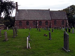
 St. James' Church, Hayton | |
| Location | |
| Grid reference: | NY107415 |
| Location: | 54°45’38"N, 3°23’18"W |
| Data | |
| Population: | 237 (2011) |
| Post town: | Wigton |
| Postcode: | CA7 2 |
| Dialling code: | 016973 |
| Local Government | |
| Council: | Cumberland |
| Parliamentary constituency: |
Workington |
Hayton is a village in western Cumberland, on a minor road between the B5300 and the A596. It is approximately a mile and a half from the coast, and just over two miles from the nearest town, Aspatria. Close by are such villages as Allonby, Oughterside and Prospect.
A small tributary stream called Patten Beck runs across the village, through the grounds of the castle, on its way to the Crookhurst Beck, which reaches the sea at Allonby.[1]
The village had just 89 households at the 2001 census, with a total population of 229. The largest population was recorded in the 1921 Census when there were 346 residents within the Hayton and Mealo area; the decline is likely to be due to the change in agricultural processes and the increased use of machinery which reduced the size of labourforce needed.[2]
Amenities
The village does have a church,; it lacks any other services or facilities. The nearest shops are located in nearby Aspatria. The village has one small family shop, a phone box, a bench and a postbox.
History
To the north-east of the village stands Hayton Castle, which is a Grade I listed building.[3]
In 1870–72, John Marius Wilson's Imperial Gazetteer of England and Wales described Hayton as:
"A township and a chapelry in Aspatria parish, Cumberland; on the coast, 2½ miles W of Aspatria r. station. They have a post-office under Maryport. The township includes Mealo, and comprises 1,971 acres. Pop., 390. The chapelry was constituted in 1867. Pop., 1,095. The living is a rectory. Value, £300."[4]
Outside links
| ("Wikimedia Commons" has material about Hayton, Aspatria) |
References
- ↑ "Old Maps – Hayton, Allerdale". http://www.old-maps.co.uk/maps.html. Retrieved 23 March 2012.
- ↑ "Vision of Britain". http://www.visionofbritain.org.uk/data_cube_page.jsp?data_theme=T_POP&data_cube=N_TOT_POP&u_id=10178113&c_id=10001043&add=N. Retrieved 23 March 2012.
- ↑ Hayton Castle - British Listed Buildings
- ↑ Vision of Britain – Wilson, John Marius: Imperial Gazetteer of England and Wales (A. Fullerton & Co., 1870)