Greetham, Rutland
| Greetham | |
| Rutland | |
|---|---|
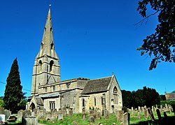
 St Mary the Virgin parish church | |
| Location | |
| Grid reference: | SK9214 |
| Location: | 52°43’12"N, -0°37’52"W |
| Data | |
| Population: | 609 (2001[1]) |
| Post town: | Oakham |
| Postcode: | LE15 |
| Dialling code: | 01572 |
| Local Government | |
| Council: | Rutland |
| Parliamentary constituency: |
Rutland and Melton |
| Website: | Greetham, Rutland |

Greetham is a village and parish in the county of Rutland. The village is on the B668 road between the county town of Oakham and the A1. It lies on the north-south Viking Way long-distance footpath linking the Humber Bridge and Oakham. The population of the civil parish at the 2001 census was 609 increasing to 638 at the 2011 census.[2]
The oldest parts of the Church of England parish church of St Mary the Virgin are Norman, but the church today is largely as it was rebuilt in the 13th–15th centuries.[3][4] The west tower and spire are 13th or 14th century and the south porch was built in 1673.[3][4] The church is a Grade-I-listed building.[4]
Leicestershire and Rutland Wildlife Trust owns Merry's Meadows nature reserve,[5] a Site of Special Scientific Interest in the parish that is important for species characteristic of unimproved grassland. East of the village just before the Sewstern Lane junction, just north of the B668 is Greetham Lime Quarry[6] owned by the Dickerson Group of Waterbeach.
Greetham has three pubs: the Plough, the Black Horse Inn and the Wheatsheaf, all on the B668. To the east is the Greetham Valley golf course.[7] On the A1 near Stretton is a former pub, the Olde Greetham Inn, now owned by Construction Interior Design.
Notable people
- Harold Lawton (1899–2005), one of the last First World War veterans
- John Senescall (1853–1937), cricketer
References
- ↑ "Rutland Civil Parish Populations". Rutland County Council. 2001. http://www.rutland.gov.uk/ppimageupload/Image27657.PDF. Retrieved 15 February 2009.
- ↑ "Civil Parish population 2011". Neighbourhood Statistics. Office for National Statistics. http://www.neighbourhood.statistics.gov.uk/dissemination/LeadKeyFigures.do?a=7&b=11124011&c=Greetham&d=16&e=62&g=6384735&i=1001x1003x1032x1004&m=0&r=1&s=1466846651886&enc=1. Retrieved 25 June 2016.
- ↑ 3.0 3.1 Pevsner 1960, p. 301.
- ↑ 4.0 4.1 4.2 "Church of St Mary, Church Lane". National Heritage List for England. English Heritage. 14 June 1954. http://list.english-heritage.org.uk/resultsingle.aspx?uid=1073218. Retrieved 29 July 2013.
- ↑ "Merry Meadows nature reserve". Leicestershire and Rutland Wildlife Trust. http://www.lrwt.org.uk/pp/Silver/viewSilver.asp?ID=316.
- ↑ "Greetham Lime Quarry". Geograph. http://www.geograph.org.uk/photo/114398.
- ↑ Golf club
Sources
- Pevsner, Nikolaus (1960). Leicestershire and Rutland. The Buildings of England. Harmondsworth: Penguin Books. p. 301.
Outside links
| ("Wikimedia Commons" has material about Greetham, Rutland) |