Cherry Green, Hertfordshire
Jump to navigation
Jump to search
| Cherry Green | |
| Hertfordshire | |
|---|---|
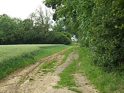
 The Roman road at Cherry Green | |
| Location | |
| Grid reference: | TL361252 |
| Location: | 51°54’33"N, 0°1’22"W |
| Data | |
| Post town: | Buntingford |
| Postcode: | SG9 |
| Local Government | |
| Council: | East Hertfordshire |
Cherry Green is a hamlet in eastern Hertfordshire. It lies on an out-of-the-way lane with the nice village of Nasty to the south and its companion Mundford. To east is Westmill, Hertfordshire. The little town of Buntingford lies to the north, on the A10.
The ancient course of a Roman road runs by Cherry Green, now visible as a bridleway, whose course heads northwest to Baldock and beyond.
This Hertfordshire article is a stub: help to improve Wikishire by building it up.