Brawdy
| Brawdy Welsh: Breudeth | |
| Pembrokeshire | |
|---|---|

| |
| Location | |
| Location: | 51°52’25"N, 5°6’47"W |
| Data | |
| Population: | 611 (2001) |
| Post town: | Haverfordwest |
| Postcode: | SA62 |
| Dialling code: | 01437 |
| Local Government | |
| Council: | Pembrokeshire |
| Parliamentary constituency: |
Carmarthen West and South Pembrokeshire |
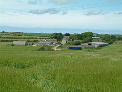
Brawdy is a village and parish in Pembrokeshire situated at the north-east corner of St Bride's Bay. The southern half of the parish lies in the Pembrokeshire Coast National Park and it has over two miles of coastline accessible by the Pembrokeshire Coast Path.
The Welsh-language name Breudeth appears to be an archaic form of "Bridget" and the parish may originally have been Llanfreudeth. The English name is a corruption of the Welsh.[1]
The parish includes the villages of Penycwm and Newgale and the hamlets of Eweston, Tancredston and Trefgarn Owen. The parish church of St David is a Grade II* listed building. [2]
The ancient parish has an area of 5,535 acres. Its census populations were: 572 (1801): 753 (1851): 467 (1901): 425 (1951): 798 (1981, of which around 400 were military). The Landsker Line corresponds roughly with the southern boundary of the parish, and it has historically been more Welsh-speaking (excluding military personnel from the Royal Signals Regiment who are based in the former RN and RAF Station). This is less so today with only 36% Welsh speakers.
During the second half of the 20th century, it was home to a large Fleet Air Arm and later a RAF Brawdy.
References
- ↑ Charles, B. G., The Placenames of Pembrokeshire, National Library of Wales, Aberystwyth, 1992, ISBN 0-907158-58-7, p 198
- ↑ "Church of Saint David,, Brawdy". British Listed Buildings. http://www.britishlistedbuildings.co.uk/wa-14396-church-of-saint-david-brawdy. Retrieved 21 December 2013.
Outside links
| ("Wikimedia Commons" has material about Brawdy) |