Brampton Ash
Jump to navigation
Jump to search
| Brampton Ash | |
| Northamptonshire | |
|---|---|

| |
| Location | |
| Grid reference: | SP7887 |
| Location: | 52°28’47"N, -0°50’42"W |
| Data | |
| Post town: | Market Harborough |
| Postcode: | LE16 |
| Dialling code: | 01858 |
| Local Government | |
| Council: | North Northamptonshire |
| Parliamentary constituency: |
Kettering |
Brampton Ash is a village in Northamptonshire, in northof the county close to the border of Leicestershire. It the nearest towns are Corby, Kettering, Desborough and Market Harborough; the latter bisected by the county border. Running past the north of the village is the A427 road which connects Market Harborough to Oundle.
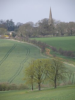
The parish chuch is St Mary the Virgin, and is the main feature of the village.
The village's name is of two parts: 'Bramptn' appears to be the Old English Brom tun, meaning 'Broom farm/settlement', while 'Ash' indicateds an abundance of those trees.[1]
Within Brampton Ash are the remains of a stone quarry.
Outside links
| ("Wikimedia Commons" has material about Brampton Ash) |