Ballyboden
Jump to navigation
Jump to search
| Ballyboden Irish: Baile Buadáin | |
| County Dublin | |
|---|---|
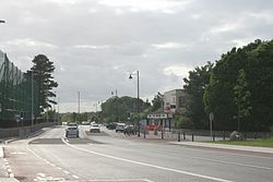
 Taylor's Lane, Ballyboden | |
| Location | |
| Grid reference: | O144289 |
| Location: | 53°16’55"N, 6°17’24"W |
| Data | |
| Population: | 5,193 (2006) |
| Postcode: | D16 |
| Local Government | |
| Council: | South Dublin |
| Dáil constituency: |
Dublin South-West |
Ballyboden is a village now swallowed within Rathfarnham in the south of County Dublin. It stands at the foot of the Dublin Mountains between Whitechurch, Ballyroan and Knocklyon.
The name 'Ballyboden' is rendered in Irish as Baile Buadáin, meaning 'Boden Town'. It is a townland in the Barony of Uppercross.
The Pearse Museum is just east of the village centre.
Churches
- Church of Ireland: a mediæval church in Whitecross
- Roman Catholic: parish of Ballyboden established in 1973 out of Rathfarnham parish
The Roman Catholic parish is under the control of the Augustinian Order, who established a house of studies in Ballyboden in 1955, providing a two-year course in philosophy. The Augustinians had acquired Orlagh as a Novitiate in 1872.
Sport
- Gaelic Athletics:
- Ballyboden Wanderers, who play in Mount Venus Road
- Ballyboden St Enda's, who play at Sancta Maria College