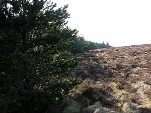
Wholhope Hill
From Wikishire
Revision as of 17:33, 31 August 2015 by RB (Talk | contribs) (Created page with "{{Infobox hill |name=Wholhope Hill |county=Northumberland |range=Cheviot Hills |picture=Edge of forest on Wholhope Hill - geograph.org.uk - 1214191.jpg |picture caption=Forest...")
| Wholhope Hill | |||
| Northumberland | |||
|---|---|---|---|
 Forest edge on Wholhope Hill | |||
| Range: | Cheviot Hills | ||
| Summit: | 1,847 feet NT941117 55°23’50"N, 2°5’40"W | ||
Wholhope Hill is a hill amongst the Cheviot Hills, in Northumberland. It reaches 1,847 feet, standing though a little away from the main groups of the Cheviots' higher peaks. The Kidland Forest stretches over the hill's western slopes and beyond.
Two of the main source streams of the River Alwin rise on the slopes of Wholhope Hill; the Wholhope Burn and the Allerhope Burn.