Weldon, Northumberland
From Wikishire
Revision as of 20:49, 8 February 2024 by RB (Talk | contribs) (Created page with "{{Infobox town |name=Weldon |county=Northumberland |picture=Weldon Bridge - geograph.org.uk - 4640250.jpg |picture caption=Weldon Bridge |os grid ref=NZ137986 |latitude=55.281...")
| Weldon | |
| Northumberland | |
|---|---|
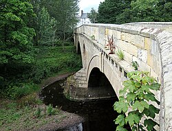
 Weldon Bridge | |
| Location | |
| Grid reference: | NZ137986 |
| Location: | 55°16’54"N, 1°47’8"W |
| Data | |
| Local Government | |
Weldon is a small village beside the River Coquet in Northumberland. The A697 crosses the Coquet here, in an arrow-straight line on its way north from Morpeth to Longframlington and beyond to Wooler.