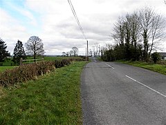
Tattykeeran, Fermanagh
From Wikishire
Revision as of 17:45, 19 December 2020 by RB (Talk | contribs) (Created page with "{{Infobox townland |name=Tattykeeran |county=Fermanagh |picture=Road through Tattykeeran, Fermanagh - geograph-2820798.jpg |picture caption= |os grid ref=H377467 |latitude=54....")
| Tattykeeran TOWNLAND | |
| Fermanagh | |
|---|---|

| |
| Location | |
| Location: | 54°22’5"N, 7°25’12"W |
| Grid reference: | H377467 |
| Data | |
Tattykeeran is a townland of 459 acres in Fermanagh. It is in the Parish of Aghavea and the Barony of Magherastephana.[1]
The name of the place is from an old Ulster land division, a 'tate', used in Counties Fermanagh, Tyrone, Monaghan and Louth: 'Tattykeeran' is from Taite an Chaorthainn meaning 'Tate of the rowans'.[2]
References
- ↑ "Tattykeeran". http://www.thecore.com/seanruad/. Retrieved 5 May 2015.
- ↑ Tattykeeran - Placenames NI