Difference between revisions of "Stoneyford, Derbyshire"
| Line 1: | Line 1: | ||
{{Infobox town | {{Infobox town | ||
| − | |name=Stoneyford | + | |name=Stoneyford |
|county=Derbyshire | |county=Derbyshire | ||
|picture=The road to Stoneyford Lodge - geograph.org.uk - 18230.jpg | |picture=The road to Stoneyford Lodge - geograph.org.uk - 18230.jpg | ||
| Line 8: | Line 8: | ||
|longitude=-1.341635 | |longitude=-1.341635 | ||
|postcode=NG16 | |postcode=NG16 | ||
| − | |post town= | + | |post town=Nottingham |
|population= | |population= | ||
|census year= | |census year= | ||
| Line 23: | Line 23: | ||
The nearest villages of any size are [[Codnor]] a mile and a half to the west, [[Ironville]] a mile and a half northwards, and [[Heanor]] about the same distance to the south. The north-south railway line along the Erewash valley slices past Stoneyford. | The nearest villages of any size are [[Codnor]] a mile and a half to the west, [[Ironville]] a mile and a half northwards, and [[Heanor]] about the same distance to the south. The north-south railway line along the Erewash valley slices past Stoneyford. | ||
| − | The hamlet's lane continues eastwards over the railway line, crossing the river into Nottinghamshire, now on a footbridge rather | + | The hamlet's lane continues eastwards over the railway line, crossing the river into Nottinghamshire, now on a footbridge rather than through a ford. |
| − | + | ||
| − | + | ||
==References== | ==References== | ||
Latest revision as of 21:15, 29 November 2017
| Stoneyford | |
| Derbyshire | |
|---|---|
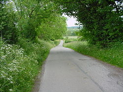
 The road to Stoneyford Lodge | |
| Location | |
| Grid reference: | SK442494 |
| Location: | 53°2’26"N, 1°20’30"W |
| Data | |
| Post town: | Nottingham |
| Postcode: | NG16 |
| Local Government | |
| Council: | Amber Valley |
Stoneyford is a tiny hamlet in Derbyshire, in the east of the county at the end of a minor dead-end lane. It is just 500 yards from to the upper course of the River Erewash, which here forms the border with Nottinghamshire.
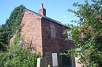
This was once a small industrial village but it has fallen into decline: an Ordnance Survey Map of 1881 shows a 'Stoneyford Colliery', which has since disappeared. The Cromford Canal, which now stops short between here and Ironville, used to run through to Stoneyford, and a canalside cottage remains as a memory. At the time of the 1891 Census, Stoneyford had 33 households, mainly inhabited by coal miners and their families, but few houses now remain.
There was also once a church, Holy Trinity, which was closed at some time before 1970 and has since been demolished.[1]
The nearest villages of any size are Codnor a mile and a half to the west, Ironville a mile and a half northwards, and Heanor about the same distance to the south. The north-south railway line along the Erewash valley slices past Stoneyford.
The hamlet's lane continues eastwards over the railway line, crossing the river into Nottinghamshire, now on a footbridge rather than through a ford.
