Difference between revisions of "South Zeal"
(Created page with "{{Infobox town |name=South Zeal |county=Devon |picture=Market cross, South Zeal - geograph.org.uk - 1092508.jpg |picture caption=South Zeal |os grid ref=SX650935 |latitude=50....") |
|||
| Line 9: | Line 9: | ||
|population= | |population= | ||
|census year= | |census year= | ||
| − | |post town= | + | |post town=Okehampton |
|postcode=EX20 | |postcode=EX20 | ||
|dialling code= | |dialling code= | ||
| Line 15: | Line 15: | ||
|constituency= | |constituency= | ||
}} | }} | ||
| − | '''South Zeal''' is a small village on [[Dartmoor]], in [[Devon]], at the north edge of the High Moor, four miles east of [[Okehampton]]. The village just to the north-west is [[Sticklepath]], separated from South Zeal by the valley of the [[ | + | '''South Zeal''' is a small village on [[Dartmoor]], in [[Devon]], at the north edge of the High Moor, four miles east of [[Okehampton]]. The village just to the north-west is [[Sticklepath]], separated from South Zeal by the valley of the [[River Taw]], while to the north is [[South Tawton]], a smaller village but the mother village of the parish. |
| − | There is a Methodist chapel in South Zeal, but no Church of England church: the parish church stands in South Tawton. | + | There is a Methodist chapel in South Zeal, but no [[Church of England]] church: the parish church stands in South Tawton. |
The village grew around the manorial hall of the Manor of South Zeal, the estate of which included much pf South Tawton. The manor house was built around a former monastery which itself was built around a Neolithic standing stone called the South Zeal Menhir. The house is now the ''Oxenham Arms''; an inn and hotel in the centre of the village. | The village grew around the manorial hall of the Manor of South Zeal, the estate of which included much pf South Tawton. The manor house was built around a former monastery which itself was built around a Neolithic standing stone called the South Zeal Menhir. The house is now the ''Oxenham Arms''; an inn and hotel in the centre of the village. | ||
Latest revision as of 14:09, 22 February 2023
| South Zeal | |
| Devon | |
|---|---|
 South Zeal | |
| Location | |
| Grid reference: | SX650935 |
| Location: | 50°43’34"N, 3°54’46"W |
| Data | |
| Post town: | Okehampton |
| Postcode: | EX20 |
| Local Government | |
| Council: | West Devon |
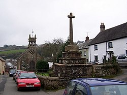
South Zeal is a small village on Dartmoor, in Devon, at the north edge of the High Moor, four miles east of Okehampton. The village just to the north-west is Sticklepath, separated from South Zeal by the valley of the River Taw, while to the north is South Tawton, a smaller village but the mother village of the parish.
There is a Methodist chapel in South Zeal, but no Church of England church: the parish church stands in South Tawton.
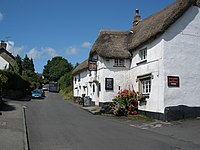
The village grew around the manorial hall of the Manor of South Zeal, the estate of which included much pf South Tawton. The manor house was built around a former monastery which itself was built around a Neolithic standing stone called the South Zeal Menhir. The house is now the Oxenham Arms; an inn and hotel in the centre of the village.
Outside links
| ("Wikimedia Commons" has material about South Zeal) |
