Scrathy Holes
From Wikishire
Revision as of 20:34, 2 September 2015 by RB (Talk | contribs) (Created page with "{{Infobox hill |name=Scrathy Holes |county=Roxburghshire |range=Cheviot Hills |picture=Wauchope Forest from Scrathy Holes - geograph.org.uk - 848189.jpg |picture caption=Wauch...")
| Scrathy Holes | |||
| Roxburghshire | |||
|---|---|---|---|
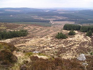
 Wauchope Forest from Scrathy Holes | |||
| Range: | Cheviot Hills | ||
| Summit: | 1,709 feet NT638031 55°19’15"N, 2°34’10"W | ||
Scrathy Holes is a summit beside the higher top of Carlin Tooth, amongst the Cheviot Hills in Roxburghshire.
The hill is at the edge of the Wauchope Forest, which spreads out to the north and west, and is just north-west of Carter Fell, on the boundary with Northumberland.