Difference between revisions of "Sawel Mountain"
From Wikishire
(Created page with '{{Infobox hill |name=Sawel Mountain |county 1=Londonderry |county 2=Tyrone |range=Sperrins |picture=Sawel mountain.jpg |picture caption=Sawel Mountain |summit=2,224 feet |os grid…') |
|||
| Line 6: | Line 6: | ||
|picture=Sawel mountain.jpg | |picture=Sawel mountain.jpg | ||
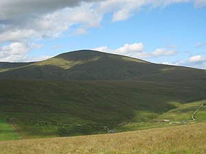
|picture caption=Sawel Mountain | |picture caption=Sawel Mountain | ||
| − | | | + | |height=2,224 feet |
|os grid ref=H618973 | |os grid ref=H618973 | ||
| + | |latitude=54.8206 | ||
| + | |longitude=-7.03779 | ||
}} | }} | ||
'''Sawel Mountain''' is a mountain of 2,224 feet in the [[Sperrins]]. It stands on the border of the counties of [[County Londonderry|Londonderry]] and [[Tyrone]], its summit marking on the boundary line. Sawel is the highest point in both counties. | '''Sawel Mountain''' is a mountain of 2,224 feet in the [[Sperrins]]. It stands on the border of the counties of [[County Londonderry|Londonderry]] and [[Tyrone]], its summit marking on the boundary line. Sawel is the highest point in both counties. | ||
Latest revision as of 09:26, 22 March 2018
| Sawel Mountain | |||
| County Londonderry, Tyrone | |||
|---|---|---|---|
 Sawel Mountain | |||
| Range: | Sperrins | ||
| Summit: | 2,224 feet H618973 54°49’14"N, 7°2’16"W | ||
Sawel Mountain is a mountain of 2,224 feet in the Sperrins. It stands on the border of the counties of Londonderry and Tyrone, its summit marking on the boundary line. Sawel is the highest point in both counties.
The mountain is composed of crystalline limestone.[1][2] Around the peak, there is heathland with plant life including heather, bilberries and cowberries, although this is being damaged by hillwalking and grazing.
Sawel is the source of the River Faughan, a 29-mile long tributary of the River Foyle.[3]
References
- ↑ Somerville, Christopher (2008-09-25). "Sperrin Hills: walk of the month". Daily Telegraph. http://www.telegraph.co.uk/travel/destinations/europe/uk/northernireland/739385/Sperrin-Hills-walk-of-the-month.html. Retrieved 2009-01-19.
- ↑ "Sperrin Mountains". Encyclopaedia Britannica. http://www.britannica.com/EBchecked/topic/849578/Sperrin-Mountains. Retrieved 2009-01-19.
- ↑ Starrett, Ian (2000-10-12). "Preserving McGilloway's ways". News Letter. http://www.highbeam.com/doc/1G1-66000348.html. Retrieved 2009-01-19.